
Last update images today East Asias Terrain: A Physical Map Exploration
East Asia's Terrain: A Physical Map Exploration
East Asia, a vibrant region brimming with history and culture, is also a land of dramatic landscapes. This week, let's delve into the physical map of East Asia, exploring its diverse features and understanding their impact on the region's development.
1. Understanding the Physical Map of East Asia: A Geographical Overview
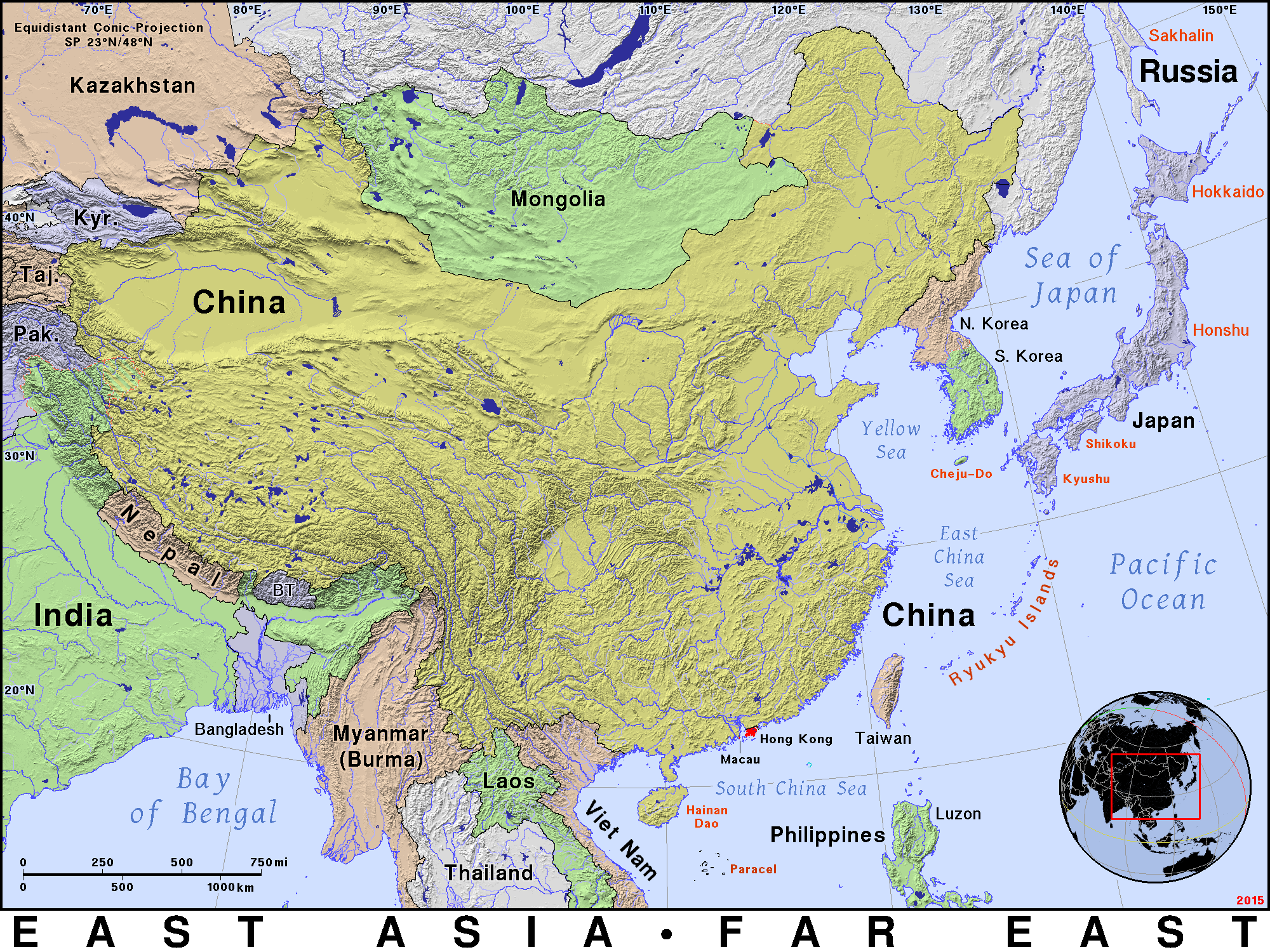
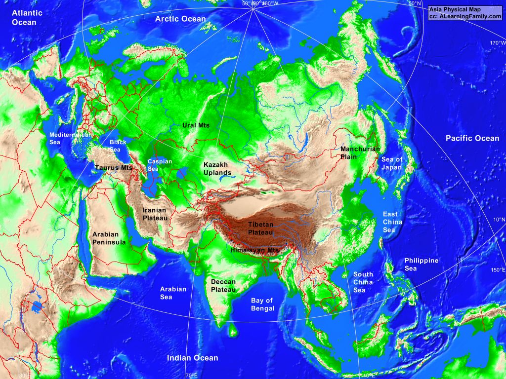
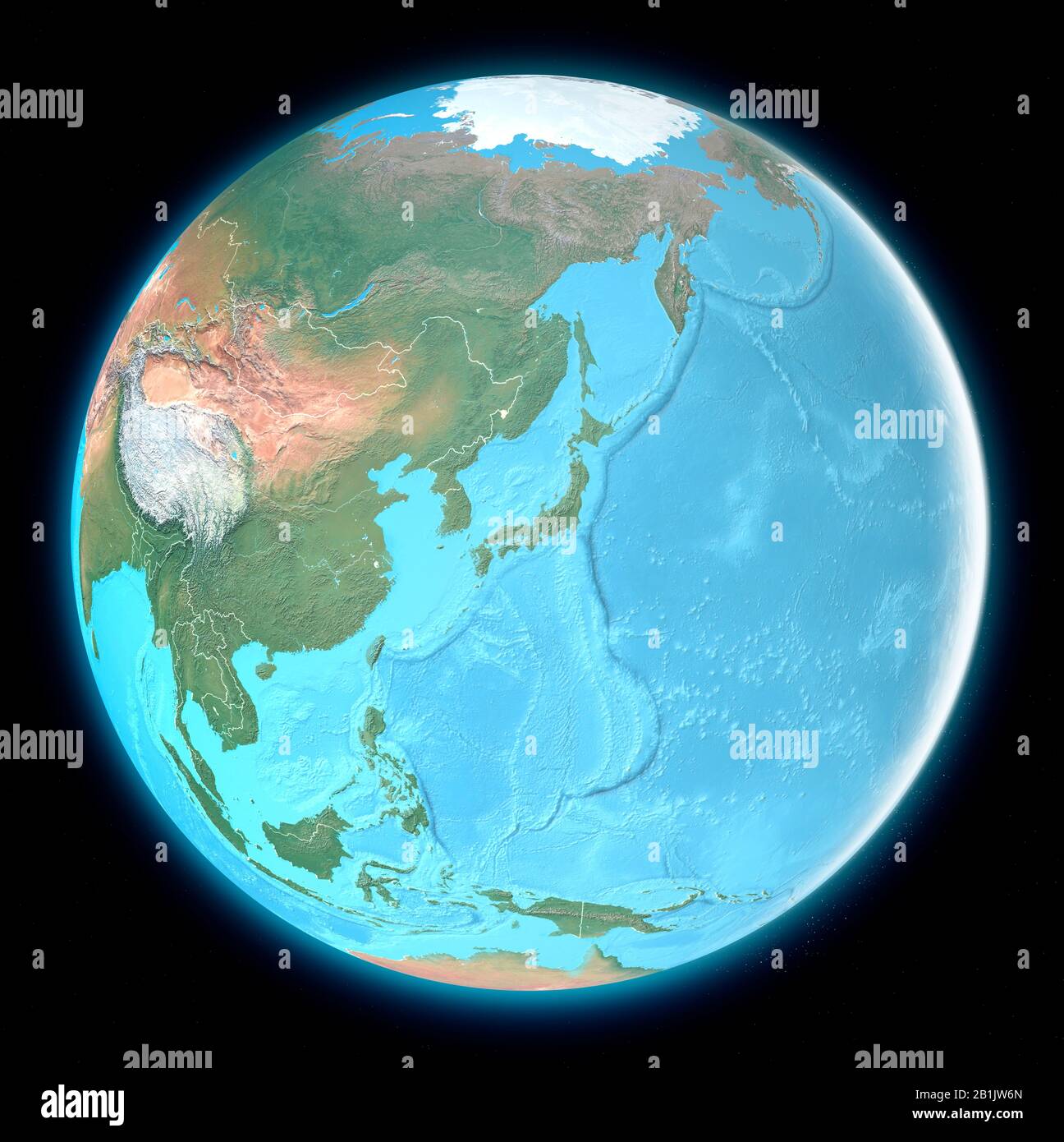
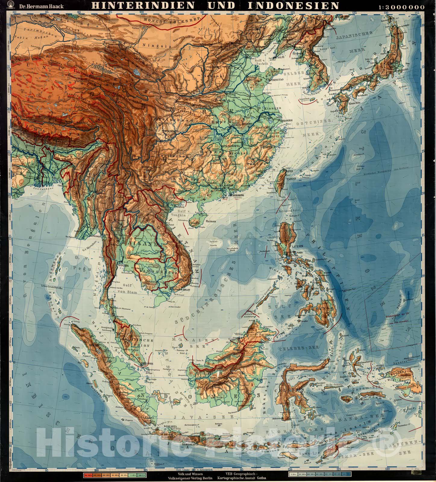
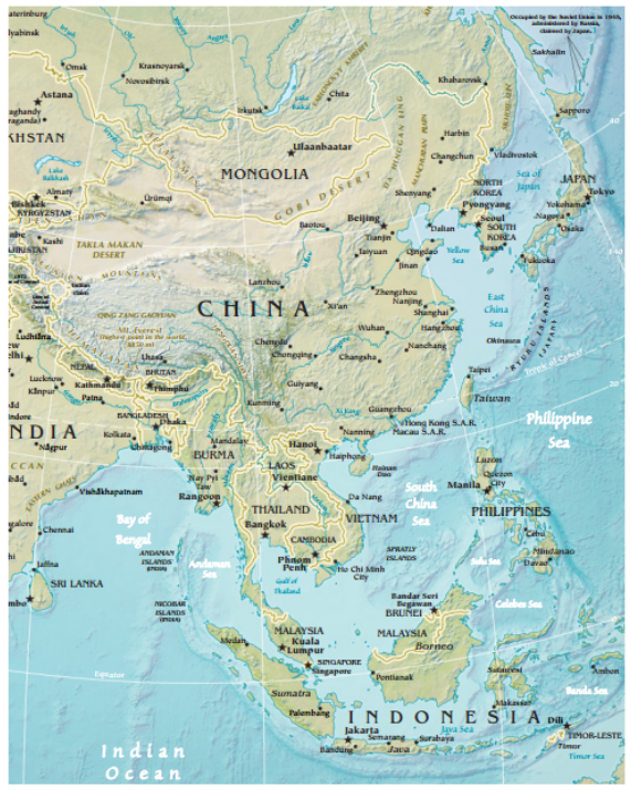
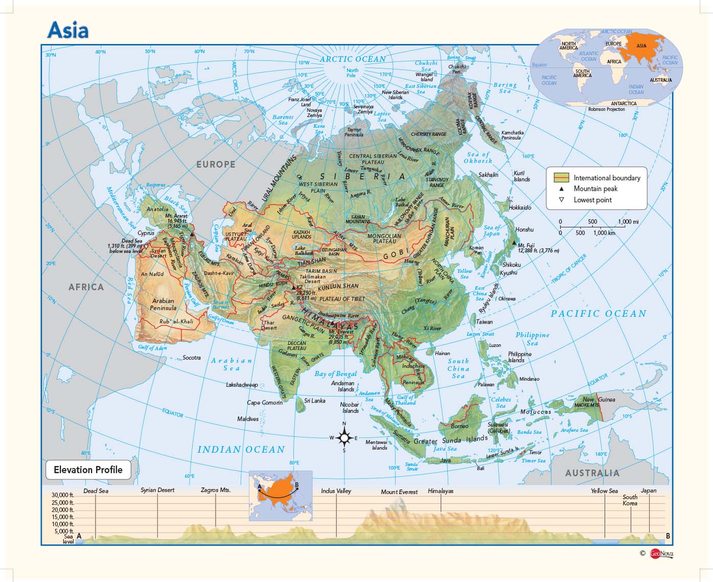
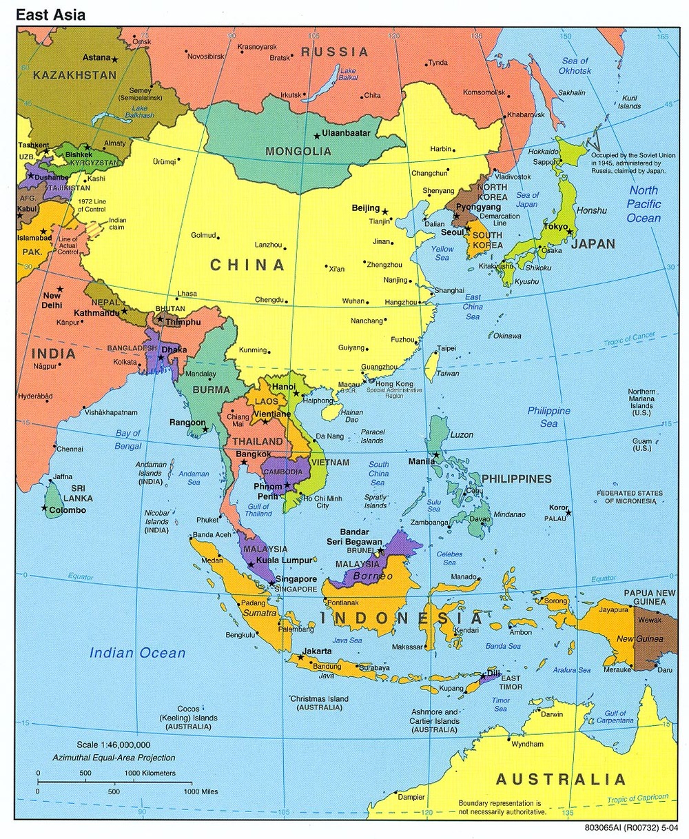
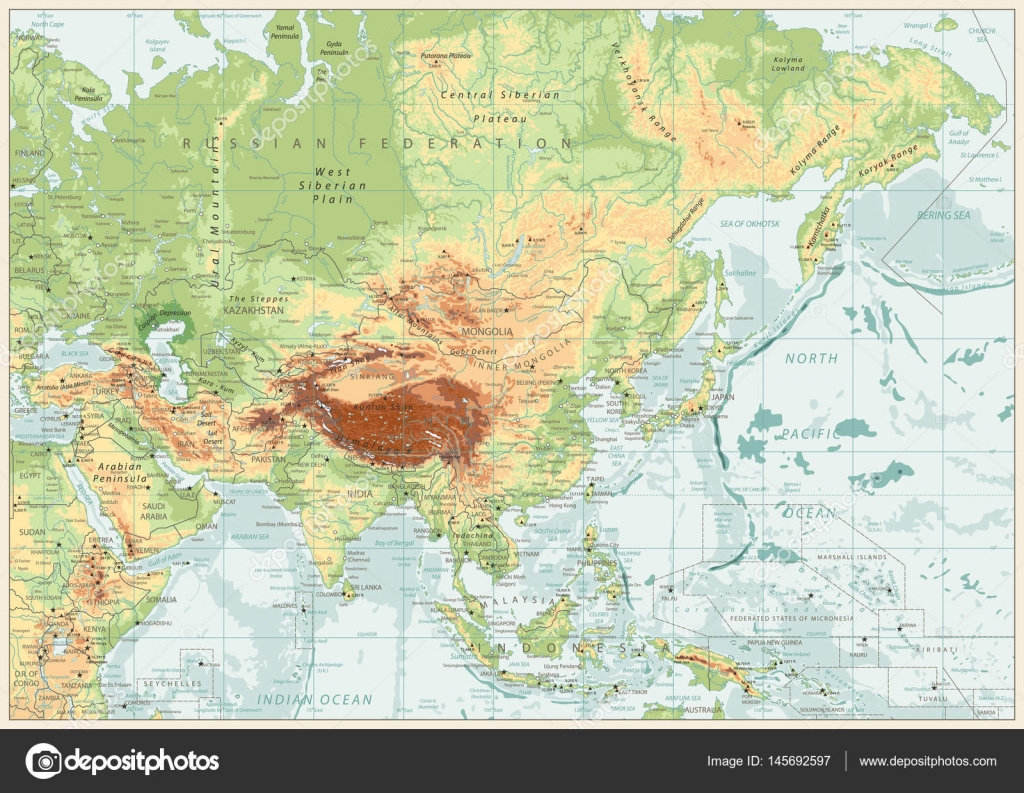
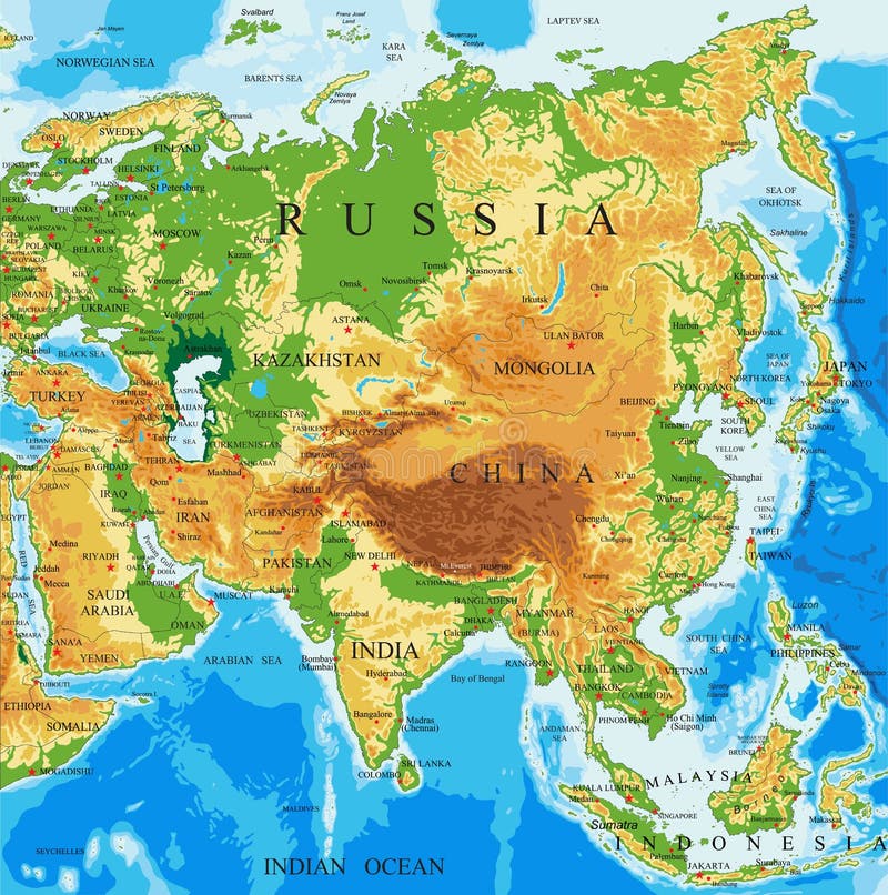
East Asia is a geographical area in the eastern part of Asia, covering approximately 11,839,074 square kilometers, about 28% of the Asian continent, or about 15% bigger than Europe. It consists of China, Hong Kong, Macau, Japan, Mongolia, North Korea, South Korea, and Taiwan.
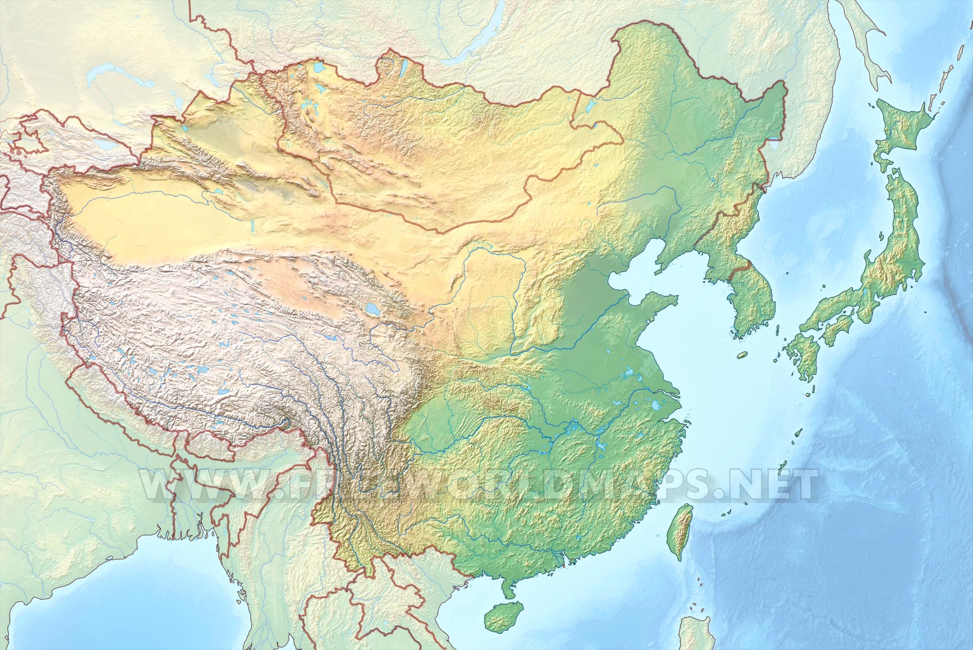
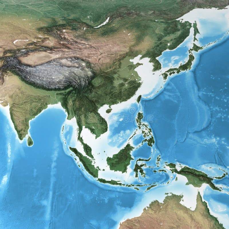
The physical map of East Asia is dominated by the vast landmass of China, which stretches from the high Tibetan Plateau in the west to the fertile plains of the east. To the east, the Japanese archipelago forms a chain of volcanic islands. The Korean Peninsula juts southwards, nestled between China and Japan. Mongolia, a landlocked country, lies to the north of China, characterized by steppes and mountains.
Caption: Relief map of East Asia
2. The Mighty Mountains: Himalayan Foothills and Volcanic Ranges on the Physical Map of East Asia
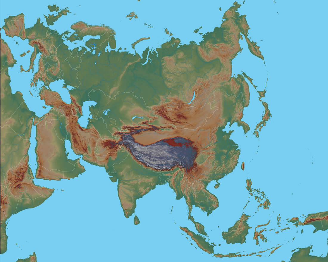
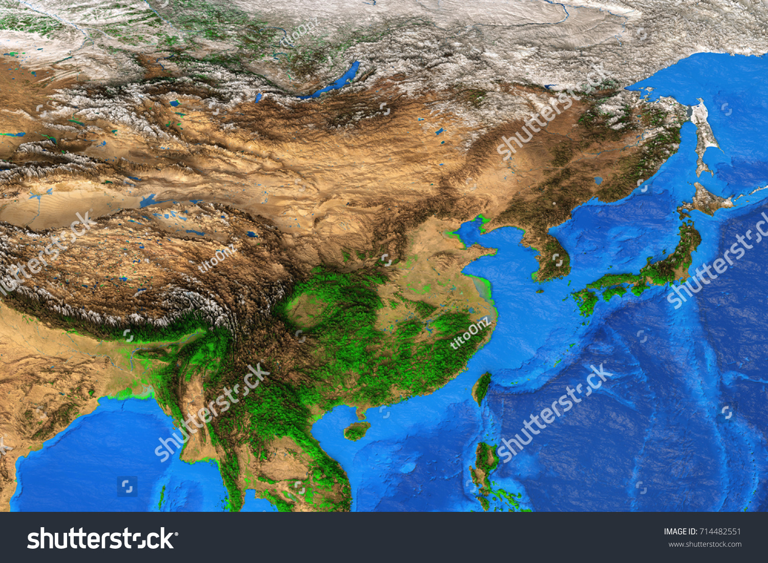
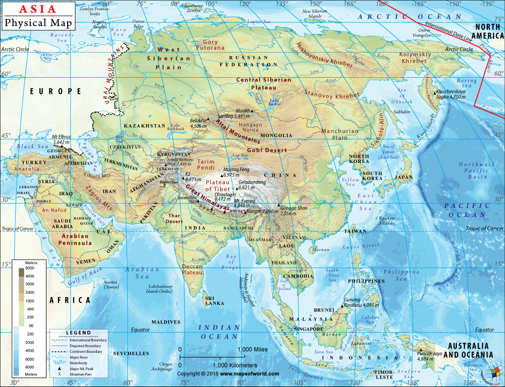
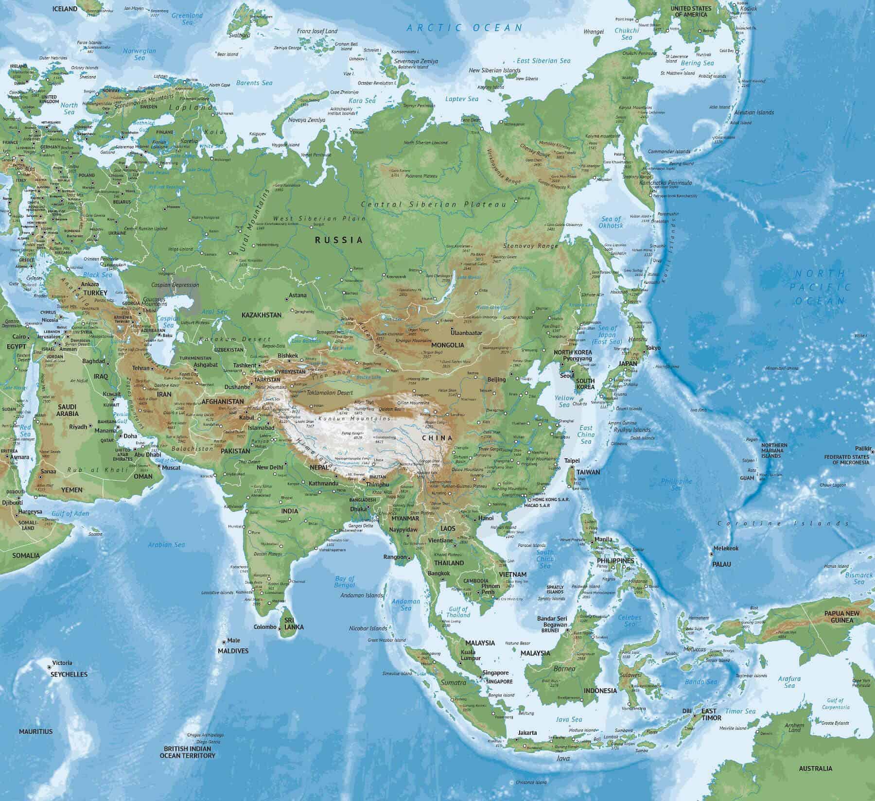
The western portion of East Asia is heavily influenced by the Himalayan mountain range. While the Himalayas themselves lie mainly outside the core East Asian region, their foothills and related ranges extend into western China, most notably the Tibetan Plateau. This massive plateau, often called the "Roof of the World," is one of the highest and largest plateaus on Earth.
Further east, the Qinling Mountains in China act as a natural divide between the north and south of the country, influencing climate and agriculture. Japan's mountainous terrain is largely volcanic in origin, with Mount Fuji being the most iconic example.
Caption: Mount Everest, part of the Himalayan range that influences East Asia
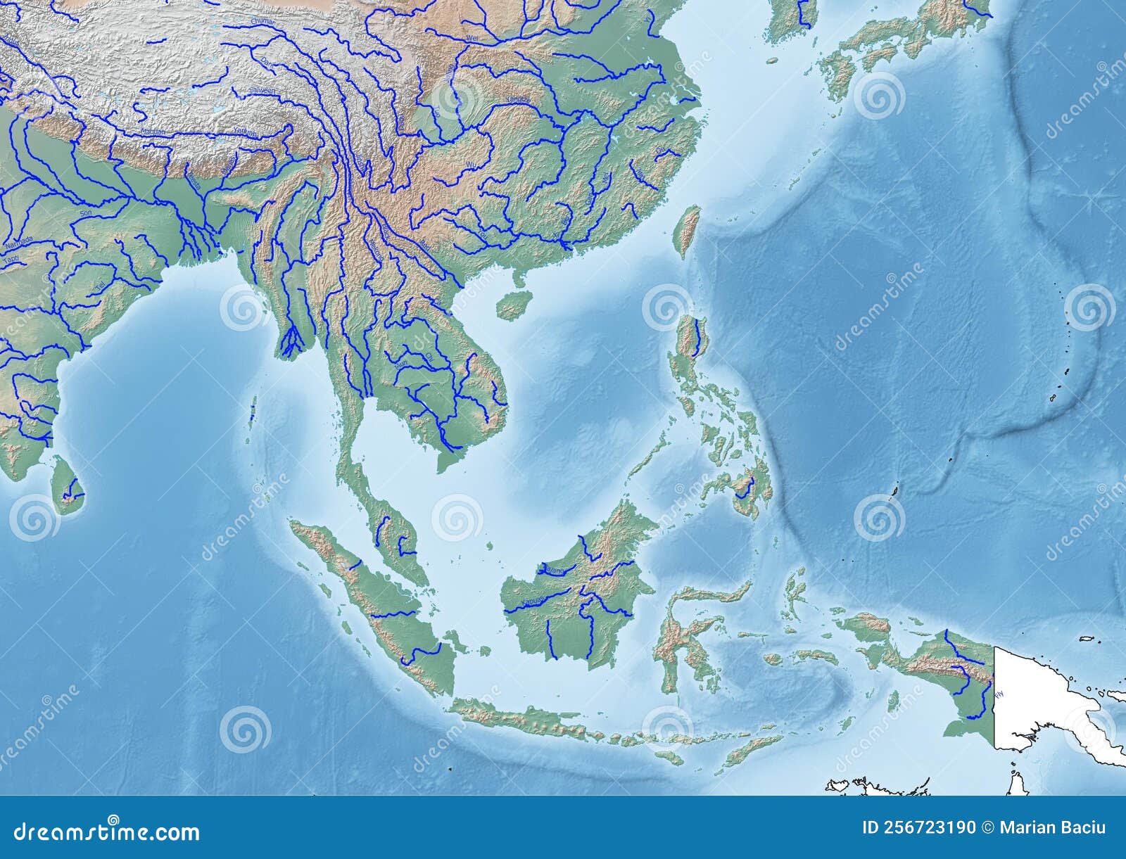
3. Rivers of Life: The Yellow, Yangtze, and Other Waterways shaping the Physical Map of East Asia
East Asia is crisscrossed by major rivers that have been vital to the region's development for millennia. The Yellow River (Huang He) in China is known as the "Mother River" of Chinese civilization, having nourished the North China Plain for centuries. However, it is also prone to devastating floods.
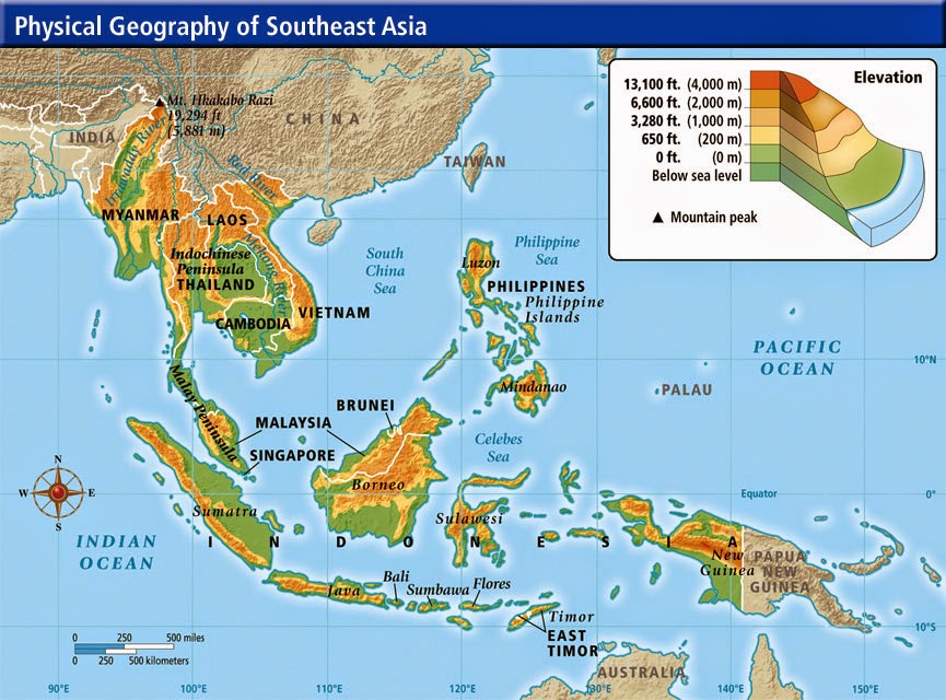
The Yangtze River (Chang Jiang), the longest river in Asia, flows through central China, providing crucial transportation, irrigation, and hydroelectric power. The Mekong River, while not exclusively in East Asia, originates in the Tibetan Plateau and flows through Southeast Asia, playing a significant role in the region's economy. The Amur River forms a significant portion of the border between Russia and China.
Caption: The Yangtze River, a vital waterway in China
4. Plains and Plateaus: Fertile Lands and Arid Regions on the Physical Map of East Asia
The North China Plain, nourished by the Yellow River, is a vast expanse of fertile land that has supported a large population for centuries. This plain is a major agricultural region, producing wheat, corn, and other crops.
In contrast, the Gobi Desert, stretching across parts of Mongolia and northern China, is a vast, arid region with extreme temperatures. The Loess Plateau in China, characterized by its fine, yellowish soil, is another distinct geographical feature.
Caption: The North China Plain, a crucial agricultural area.
5. Coastal Features: Islands, Peninsulas, and Seas within the Physical Map of East Asia
East Asia's coastline is extensive and diverse. Japan, an archipelago of over 6,800 islands, boasts a long and indented coastline. The Korean Peninsula is surrounded by the Yellow Sea to the west and the Sea of Japan (East Sea) to the east.
China's eastern coast is home to major ports and cities, facilitating trade and commerce. The South China Sea, though contested, is a vital waterway for regional and global trade.
Caption: The coastline of Japan, a nation comprised of thousands of islands
6. Climate Considerations: Monsoons, Typhoons, and Seasonal Variations affecting the Physical Map of East Asia
The physical geography of East Asia greatly influences its climate. The East Asian monsoon, driven by seasonal changes in air pressure, brings heavy rainfall to the region during the summer months. This rainfall is crucial for agriculture but can also lead to flooding.
Typhoons, similar to hurricanes, frequently strike the coastal regions of East Asia, particularly Japan, Taiwan, and China. These storms can cause significant damage and disruption. The interior regions of Mongolia and western China experience continental climates with large temperature variations and arid conditions.
Caption: Typhoon approaching East Asia
7. Impact on Human Activities: How the Physical Map of East Asia Shapes Life
The physical geography of East Asia has profoundly shaped human activities in the region. The fertile plains have supported large agricultural populations. Mountains have provided natural barriers and resources. Rivers have facilitated transportation and irrigation. Coastal areas have thrived on trade and fishing.
However, the region also faces challenges. Earthquakes, volcanic eruptions, floods, and droughts are common occurrences, requiring adaptation and resilience from the people of East Asia.
Caption: Rice paddies in East Asia, showcasing the importance of fertile land
8. Modern Challenges: Environmental Concerns and Development on the Physical Map of East Asia
Rapid economic development in East Asia has led to significant environmental challenges, including air and water pollution, deforestation, and soil erosion. Climate change is also posing a threat, with rising sea levels, increased frequency of extreme weather events, and changing agricultural patterns.
Sustainable development and environmental protection are crucial for ensuring the long-term well-being of the region and its people. Efforts are being made to address these challenges through technological innovation, policy changes, and international cooperation.
Caption: Air pollution in an East Asian city
Q: What are the major mountain ranges in East Asia? A: The Himalayan foothills (including the Tibetan Plateau) and the Qinling Mountains in China, and the volcanic mountain ranges of Japan.
Q: Which are the most important rivers in East Asia? A: The Yellow River (Huang He), the Yangtze River (Chang Jiang), the Mekong River, and the Amur River.
Q: How does the physical map of East Asia influence its climate? A: The mountains influence rainfall patterns, the monsoon brings seasonal rains, and coastal areas are prone to typhoons.
Q: What are some of the environmental challenges facing East Asia today? A: Air and water pollution, deforestation, soil erosion, and climate change.
Q: How has the physical geography of East Asia shaped human activities? A: It has determined agricultural practices, influenced settlement patterns, and shaped trade routes.
Keywords: Physical Map, East Asia, China, Japan, Korea, Mongolia, Rivers, Mountains, Climate, Geography, Terrain, Himalayas, Yangtze River, Yellow River, Coastal Features, Plateaus, Plains, Monsoon, Typhoons, Environmental Challenges.
Summary Question and Answer:
East Asia's physical map features mountains, rivers, plains, and islands shaping climate and human activities. Major rivers like the Yellow and Yangtze are vital but pose flood risks. Environmental challenges include pollution and climate change. Key mountains include the Himalayan foothills and Japan's volcanic ranges.


East Asia Physical Map Rivers Physical Map Asia Highly Detailed Vector Format All Relief Forms 76465834 9 1 The Physical Landscape Of East And Southeast Asia Social Sci Clipboard Eadfdc7fa9e5d3e3892e2c1198e32c360 East Asia Physical Map By Wilson Hein Creations TPT Original 4728308 2 Physical Map Of East Asia 559436 1wmark East Asia Physical Map Diagram Quizlet UwQE5T0R C6tMbNETCY2tQ B Labeled Physical Map Of Asia AsiaPhysical Labeled Physical Map Of Asia Asia Physical Apr07
Physical Map Of Eastern Asia Eastasia Hd Map Physical Map Of Asia Cosmographics Ltd Childrens Physical Map Of Asia758 0961 Newcopy East Asia Physical Map Eastasia High Resolution Detailed Map Of East Asia Stock Illustration Physical Map East Asia China High Resolution Details Flattened Satellite View Planet Earth Its Geography Topography D 216233261 Physical Map East Asia Detailed Satellite Stok Ll Strasyon 714482551 Stock Photo Physical Map Of East Asia Detailed Satellite View Of The Earth And Its Landforms Elements Of This 714482551 Globe Map Of East Asia Satellite View Geographical Map Physics Globe Map Of East Asia Satellite View Geographical Map Physics Cartography Relief Atlas 3d Render 2B1JW6N East Asia Physical Map East Asia Map
Asia Physical Map Rivers And Mountains Asia Physical Map Physical Map Of East Asia 81yUQokXUCL Physical Map Of East Asia With Rivers South East Asia Continent Illustration Main Rivers South East Asia Continent Illustration Main Rivers Surrounded 256723190 Physical Map Of Eastern Asia Eastasia Geography Map Labeled Physical Map Of Asia Asia Physical Map Physical Map Asia Physical Map
Free Printable Large East Asia Map AsiaEastPhysical East Asia Physical Map Depositphotos 145692597 Stock Illustration Asia Physical Map With Rivers East Asia Physical Map Original 8661521 1 Itec 2025 Asia Map Stephen Mathis Political Map Of Asia East Asia Physical Map High Resolution Detailed Map South East Asia Physical Details Flattened Satellite View Planet Earth Its Geography 217463369 East Asia Physical Map Physical Map Southeast Asia Vector Map Of Asia Continent Physical One Stop Map 751 Asia Naturalist Vm Natasia 9v2mo 1 Web Map Of Asia 2025 Aurea Suellen Asia
Physical Map Of East Asia Easablu Asia Map Asia Map East Asia Map Countries Eastasia Physical Map