
Last update images today Sumatra Map: Explore Indonesias Emerald Isle
Sumatra Map: Explore Indonesia's Emerald Isle
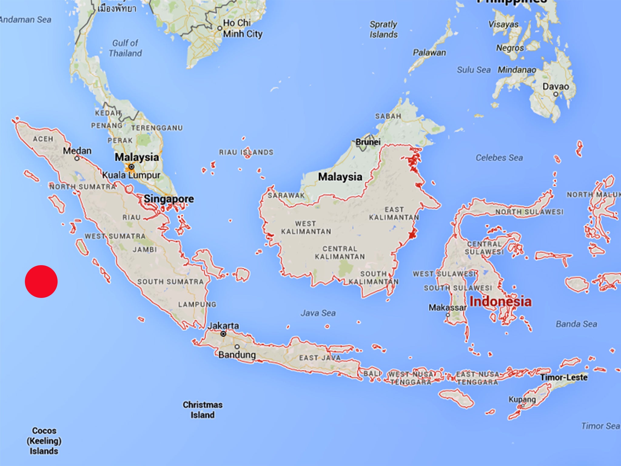
Sumatra, Indonesia's second-largest island, is a treasure trove of natural beauty, diverse cultures, and unique experiences. This week, let's delve into the captivating world of Sumatra, using its map as our guide. We'll explore its geography, key regions, and the hidden gems it holds. This guide is for everyone from seasoned travelers to armchair explorers and students interested in geography and Southeast Asian culture.
Understanding the Map of Sumatra: A Geographical Overview
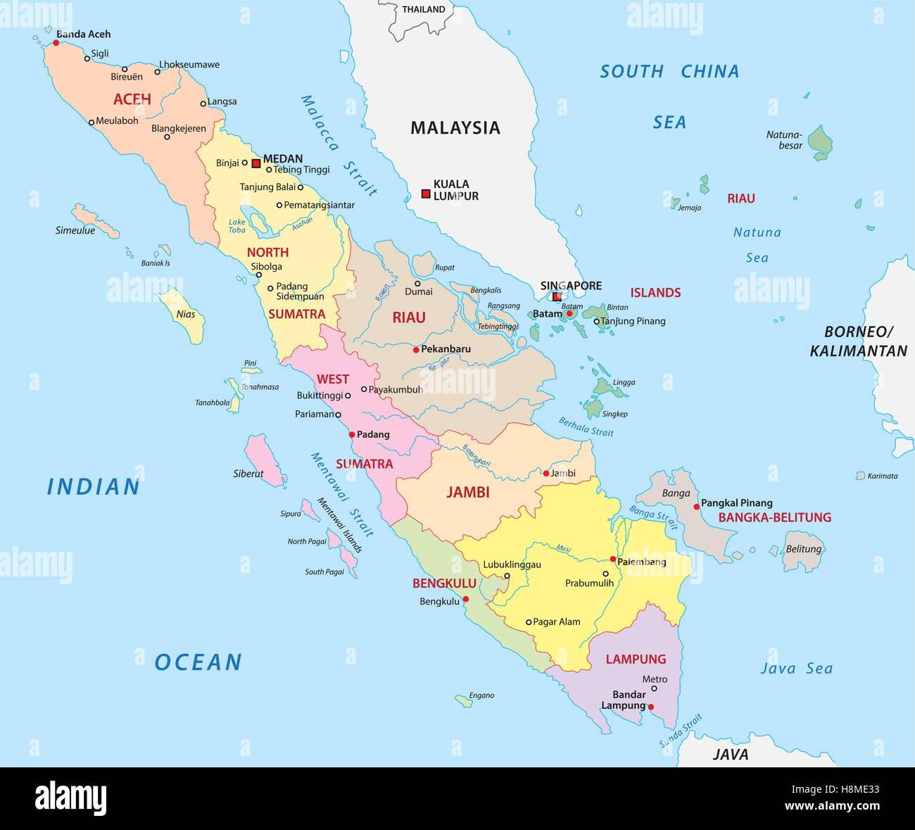
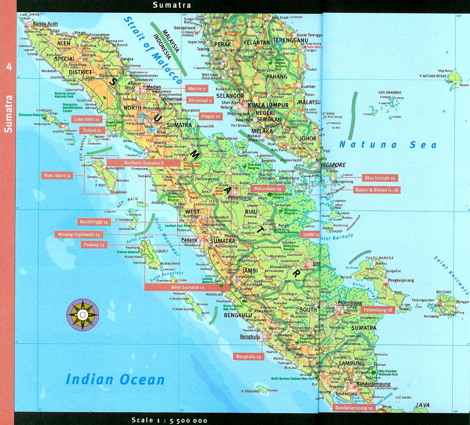
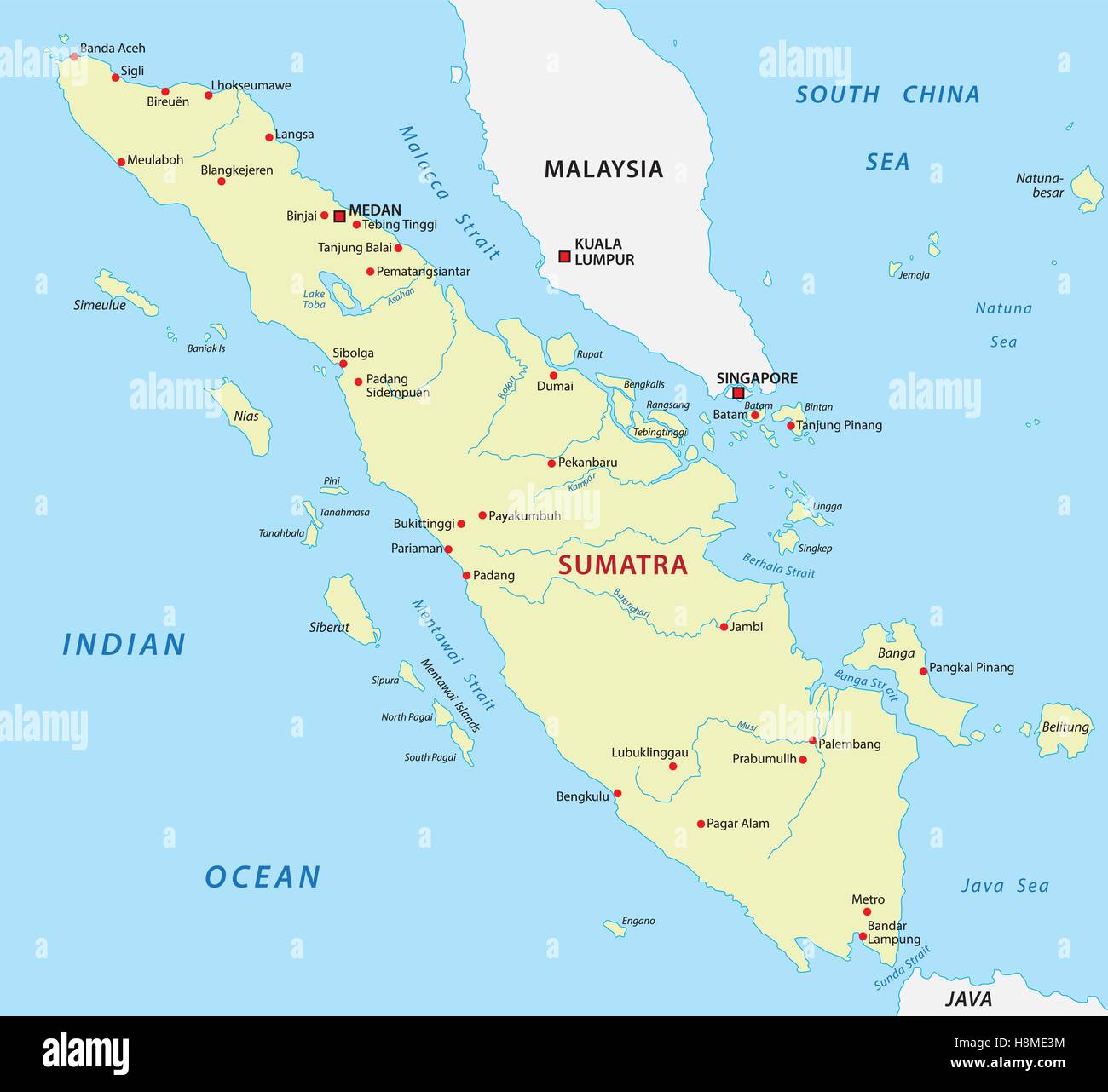
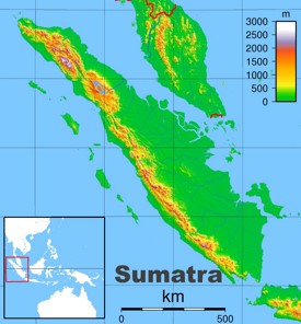
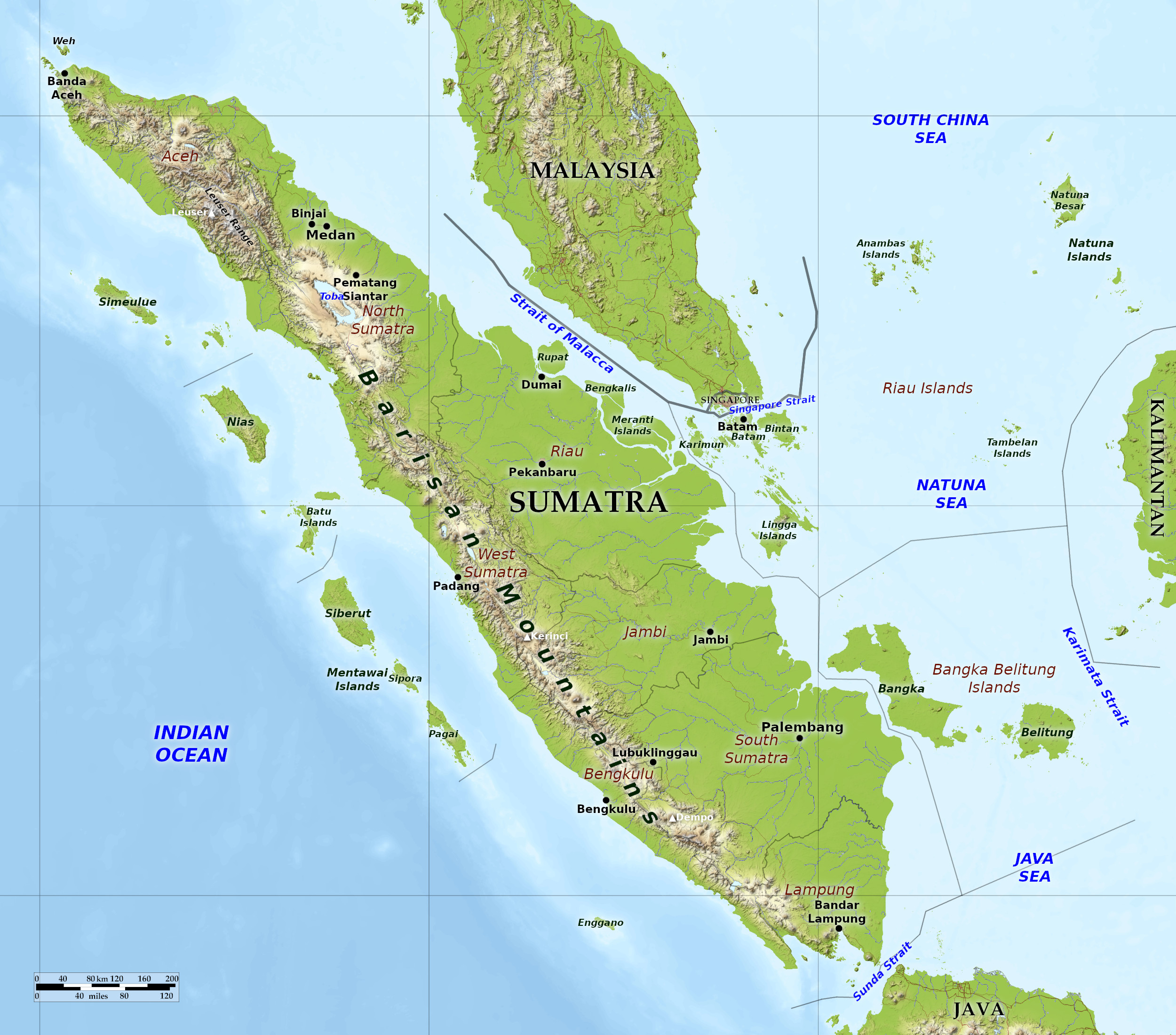
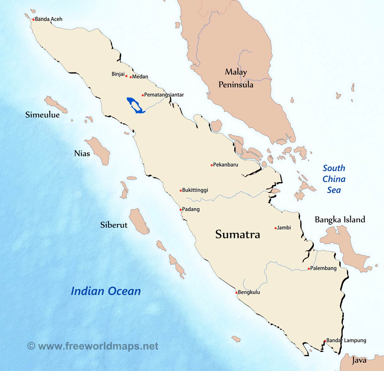
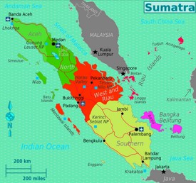
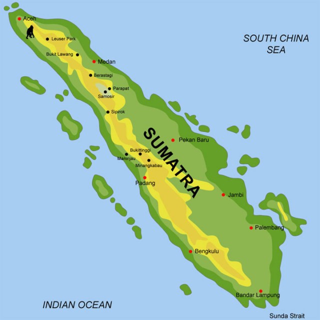
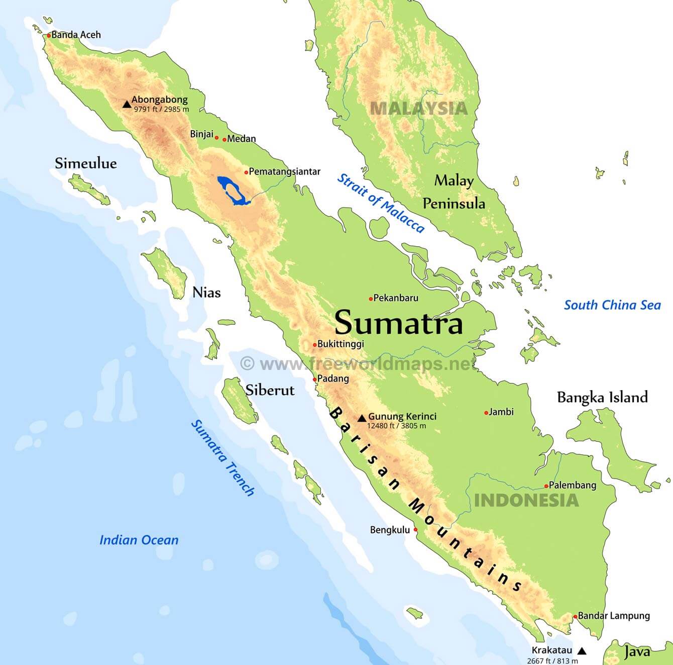
The map of Sumatra reveals a long, northwest-southeast oriented island bisected by the Barisan Mountains. These mountains form the backbone of the island, influencing its climate, vegetation, and the distribution of its population. To the east, Sumatra slopes gently towards the Strait of Malacca, forming extensive plains and swampy regions.
-
The Barisan Mountains: This range is not only a defining feature on the map of Sumatra but also a hotspot for volcanic activity. Numerous active and dormant volcanoes dot the landscape, contributing to fertile soils and stunning scenery.
Caption: The Barisan Mountains, stretching the length of Sumatra, as seen from above.
-
The Eastern Plains: Characterized by vast peatlands, rivers, and mangrove forests, the eastern plains are crucial for agriculture, especially oil palm and rubber plantations.
Navigating the Map of Sumatra: Key Regions and Their Unique Features
Let's explore some key regions visible on the map of Sumatra, each offering a distinct cultural and geographical identity.
-
Aceh: Located at the northern tip of the map of Sumatra, Aceh is known for its strong Islamic traditions and resilience. It's also a gateway to stunning beaches and lush rainforests. The 2004 tsunami devastated the region, but it has since rebuilt and is now a vibrant tourist destination.
Caption: Traditional Acehnese architecture in Banda Aceh, the provincial capital.
-
North Sumatra: Home to Lake Toba, the largest volcanic lake in the world, this region offers breathtaking landscapes and a rich Batak culture. Medan, the provincial capital, is a bustling hub for commerce and tourism.
-
West Sumatra: Known for its Minangkabau culture, characterized by its matrilineal social system and distinctive architecture (Rumah Gadang). The region boasts stunning coastlines, highlands, and the city of Padang, famous for its culinary delights (Nasi Padang).
Caption: A Rumah Gadang, a traditional Minangkabau house, with its distinctive curved roof.
-
South Sumatra: This region is a major producer of coal and petroleum. Palembang, its capital, has a rich history as a former Srivijaya empire center and is crossed by the Musi River.
-
Riau: Located on the eastern coast, Riau is characterized by its many islands and close proximity to Malaysia and Singapore. It's a major trading hub.
-
Jambi & Bengkulu: These provinces offer access to dense rainforests, national parks (Kerinci Seblat National Park straddles several provinces), and unique wildlife encounters.
Discovering Hidden Gems on the Map of Sumatra: Beyond the Tourist Trail
The map of Sumatra hides numerous off-the-beaten-path destinations for adventurous travelers.
-
Mentawai Islands: Surfers' paradise with world-class waves and unique indigenous culture. Located off the coast of West Sumatra.
-
Gunung Leuser National Park: A UNESCO World Heritage Site protecting Sumatran orangutans, tigers, elephants, and rhinos.
-
Sipiso-piso Waterfall: One of Indonesia's tallest waterfalls, plunging dramatically into Lake Toba.
Caption: The majestic Sipiso-piso Waterfall cascading into Lake Toba.
The Map of Sumatra: Practical Information for Travelers
Planning a trip to Sumatra? Here are some essential tips:
- Transportation: Flights connect major cities. Buses are a common (and often adventurous) way to travel between regions. Ferries link Sumatra to other Indonesian islands.
- Accommodation: Options range from budget guesthouses to luxury resorts.
- Language: Bahasa Indonesia is the national language. Some English is spoken in tourist areas.
- Currency: Indonesian Rupiah (IDR).
- Best Time to Visit: The dry season (April to October) is generally the best time to visit.
The Power of Informational Style: Beyond Trends, Informatif, Educatif, Beyond Refference
This article aims to be more than just a trending topic. It's a comprehensive guide to understanding Sumatra through its map, offering insightful information about its geography, culture, and attractions. The goal is to educate, inform, and inspire readers to explore this fascinating island.
Q & A About the Map of Sumatra
- Q: What is the main mountain range in Sumatra? A: The Barisan Mountains.
- Q: What is the largest lake in Sumatra? A: Lake Toba.
- Q: What are some of the unique animals that can be found in Sumatra? A: Sumatran orangutans, tigers, elephants, and rhinos.
- Q: What is the best time to visit Sumatra? A: The dry season (April to October).
- Q: What is the national language of Sumatra? A: Bahasa Indonesia
In summary, this article provided a detailed exploration of Sumatra using its map as a guide, highlighting its geography, key regions, hidden gems, and practical travel information. We also answered frequently asked questions about Sumatra.
Keywords: Map of Sumatra, Sumatra, Indonesia, Travel, Tourism, Lake Toba, Barisan Mountains, Aceh, Medan, Padang, Palembang, Gunung Leuser National Park, Mentawai Islands, Sipiso-piso Waterfall, Indonesian Islands, Sumatera.


Sumatra Map Sumatra Geography Map Large Sumatra Maps For Free Download And Print High Resolution And Sumatra Map 0 Premium Vector Sumatera Indonesia Maps Illustration Indonesia Island Cfb5240e8d32df9db091406483fce7cf Sumatra Administrative Map Stock Vector Image Art Alamy Sumatra Administrative Map H8ME33 Sumatra Map Map Sumatra Hd Elevation Map Of Sumatra With Black Background Fine Art Print Elevation Map Of Sumatra With Black Background Fine Art Print By Grasshopper Geography Licensable 4 1800x1800 Sumatra 3d Render Topographic Map Neutral Border Stock Photo Download Sumatra 3d Render Topographic Map Neutral Border
Premium Vector Vector Illustration Vector Of Sumatra Map Indonesia Vector Illustration Vector Sumatra Map Indonesia 206619 557 SUMATRA Peta Web Sumatra Sumatra Map Photos And Premium High Res Pictures Getty Images Sumatra 3d Render Topographic Map Color Sumatra Map Indonesia Discover Sumatra Island With Detailed Maps Sumatra Physical Map Min Sumatra Island World Map Indonesia Sumatra Map Sumatra Map Map Sumatra Stock Vectors Images Vector Art Shutterstock Stock Vector Sumatra Road And National Park Map 174876929
Sumatra Indonesia On World Map Dorisa Josephina Locator Map Sumatra Map Of Sumatra Hi Res Stock Photography And Images Alamy High Quality Map Of Sumatra Is The Island Of Indonesia PXJEB0 Sumatra On World Map Sumatra Map H8ME3M Sumatra Info Voyage Carte Plan Map Sumatra 3 640x640 Tectonic Map Of Sumatra Map Generated Using Generic Mapping Tools 3 Tectonic Map Of Sumatra Map Generated Using Generic Mapping Tools 3 This Map Shows
Map Of Sumatra And Surrounding Countries D76c1975ab0b0134eb26a2c4d0679ea3 Agro Climatic Map Of Sumatra ESDAC European Commission ID2000 2CL Blue Green Atlas Free Relief Map Of Indonesia Sumatra Relief Map Of Indonesia Sumatra Sumatra INSIGHTS IAS Simplifying UPSC IAS Exam Preparation Sumatra Sumatra Map Indonesia Discover Sumatra Island With Detailed Maps Administrative Divisions Map Of Sumatra Min
Map Of Sumatra High Res Vector Graphic Getty Images Map Of Sumatra Sumatra Map Sumatra Location