Last update images today Mapping America: Your Interstate Highway Guide
Mapping America: Your Interstate Highway Guide
This week, explore the intricate web of US Interstate Highways!
Unveiling the US Map with Interstate Highways: A Comprehensive Guide
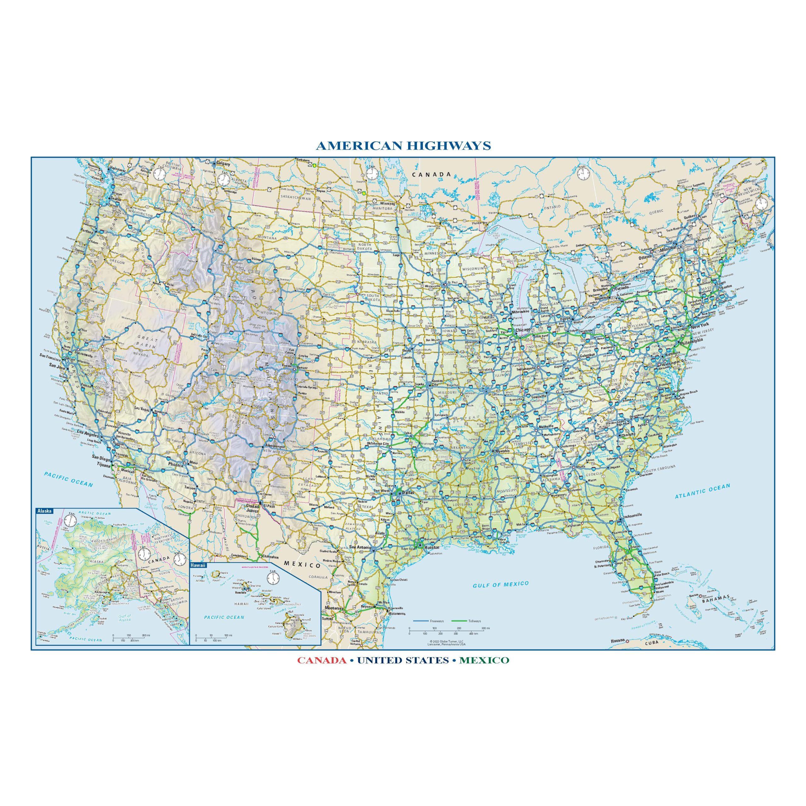
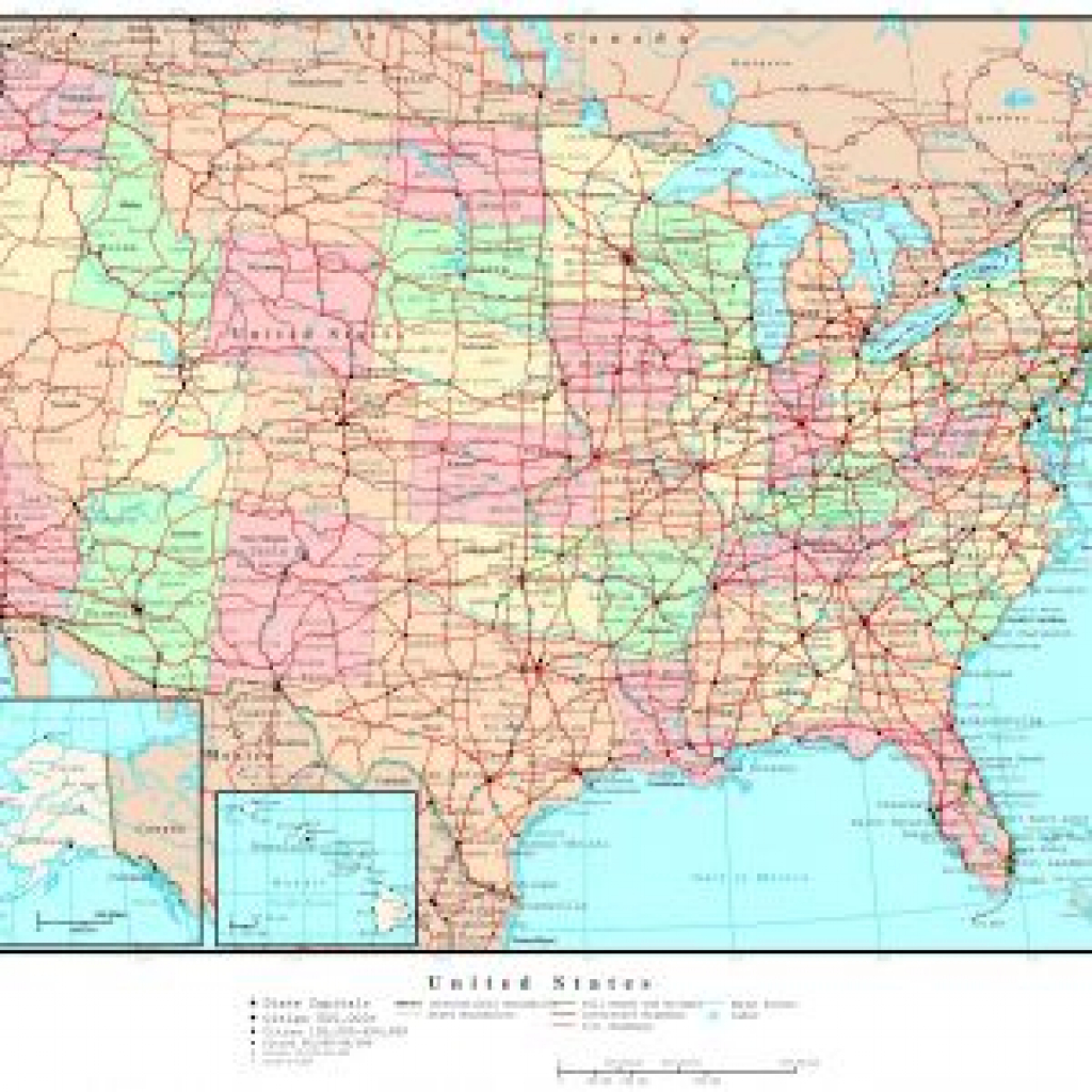
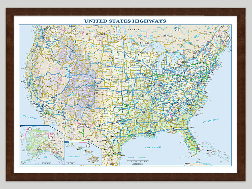
The United States interstate highway system is a marvel of engineering and planning, connecting our vast nation and facilitating the movement of people and goods. This week, we're diving deep into the world of US maps with interstate highways, exploring their history, functionality, and importance. Whether you're a seasoned traveler, a student researching transportation, or simply curious about the backbone of America's road network, this guide is for you.
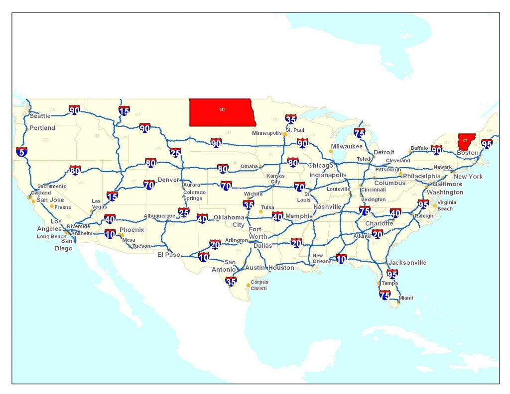
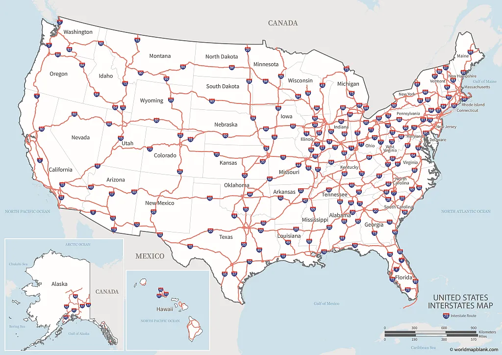
Caption: A detailed US map showcasing the extensive network of Interstate Highways.
The History of the US Map with Interstate Highways: From Vision to Reality
The idea of a national highway system began to take shape in the early 20th century, spurred by the increasing popularity of automobiles. However, it was the Federal-Aid Highway Act of 1956, championed by President Dwight D. Eisenhower, that truly set the wheels in motion. Eisenhower, inspired by the German Autobahn, envisioned a network of high-speed, limited-access highways that would connect major cities and facilitate defense transportation.
The Act authorized the construction of what was initially known as the National System of Interstate and Defense Highways. Construction began shortly after, and the network gradually expanded over the decades. Today, the Dwight D. Eisenhower National System of Interstate and Defense Highways spans over 46,000 miles, a testament to its ambitious scope and lasting impact.
Caption: President Dwight D. Eisenhower signing the Federal-Aid Highway Act of 1956.
Understanding the Numbering System on the US Map with Interstate Highways: Decoding the Routes
Navigating the US interstate highway system requires understanding its numbering system. Here's a breakdown:
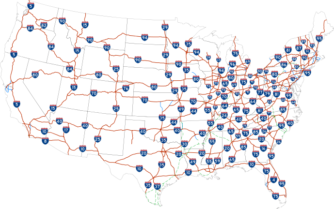
- East-West Routes: Even-numbered interstates generally run east-west. The lowest numbers are in the south (e.g., I-10 in the southern US), and the highest numbers are in the north (e.g., I-94 in the northern US).
- North-South Routes: Odd-numbered interstates generally run north-south. The lowest numbers are in the west (e.g., I-5 along the Pacific coast), and the highest numbers are in the east (e.g., I-95 along the Atlantic coast).
- Three-Digit Interstates: These are typically loop or spur routes that connect to a main interstate. The last two digits indicate the parent route. An even first digit (e.g., I-295) indicates a loop around a city, while an odd first digit (e.g., I-195) indicates a spur into a city.
Understanding these rules makes using a US map with interstate highways much easier.
Caption: Examples of interstate highway signs, highlighting the numbering system.
Navigating with a US Map with Interstate Highways: Tools and Techniques
While digital navigation systems are now commonplace, understanding how to use a physical US map with interstate highways is still a valuable skill. Here's how:
- Orientation: Orient the map so that north is aligned with north on your compass or in relation to the sun.
- Locating Routes: Use the map legend to identify the symbols for different types of interstates and other highways.
- Planning Your Route: Trace the desired route, noting the interstate numbers and any major cities or landmarks along the way.
- Estimating Distances: Use the map's scale to estimate the distances between points.
- Identifying Exits: Pay attention to exit numbers, which typically correspond to the mile marker on the interstate.
For digital navigation, apps like Google Maps, Waze, and Apple Maps are indispensable. These apps provide real-time traffic updates, alternative route suggestions, and point-of-interest information.
Caption: A person using a paper map to plan a road trip route.
The Economic Impact of the US Map with Interstate Highways: Fueling Commerce
The US interstate highway system has had a profound impact on the American economy. It has facilitated the efficient movement of goods, connecting manufacturers, distributors, and consumers across the country. This has led to increased trade, lower transportation costs, and greater economic growth.
The interstate system has also played a significant role in tourism and recreation, making it easier for people to travel to different parts of the country. This has boosted the tourism industry and created jobs in hotels, restaurants, and other related businesses.
Caption: A truck transporting goods along an interstate highway, illustrating the economic impact of the system.
The Future of the US Map with Interstate Highways: Adapting to Change
The US interstate highway system is constantly evolving to meet the changing needs of the nation. Current challenges include addressing aging infrastructure, managing congestion, and adapting to new technologies such as autonomous vehicles.
Future developments may include:
- Smart Highways: Implementing sensors and communication technologies to improve traffic flow and safety.
- Electric Vehicle Charging Infrastructure: Expanding the network of charging stations along interstates to support the adoption of electric vehicles.
- High-Speed Rail: Developing high-speed rail lines to complement the interstate system and provide an alternative mode of transportation.
Caption: A concept rendering of a "smart highway" with connected vehicles and advanced infrastructure.
Question and Answer about US Map with Interstate Highways
Q: How are interstate highways numbered? A: East-west routes are even-numbered, with lower numbers in the south. North-south routes are odd-numbered, with lower numbers in the west. Three-digit interstates are loop or spur routes.
Q: Who championed the Interstate Highway System? A: President Dwight D. Eisenhower was a key advocate.
Q: What was the initial purpose of the Interstate Highway System? A: To connect major cities and facilitate defense transportation.
Q: What are some tools for navigating the Interstate Highway System? A: Paper maps, GPS devices, and navigation apps.
Q: What is the economic impact of the Interstate Highway System? A: Facilitates trade, lowers transportation costs, and boosts tourism.
Keywords: US Interstate Highways, Interstate Map, Highway System, Road Trip Planning, Transportation, Infrastructure, Eisenhower Interstate System, Federal-Aid Highway Act, Highway Numbering System, Travel, Navigation, Route Planning, Economic Impact, Smart Highways, Autonomous Vehicles.
**Summary: This article provides a comprehensive guide to the US Interstate Highway System, covering its history, numbering system, navigation techniques, economic impact, and future developments. Key questions addressed include how interstate highways are numbered, who championed the system, its initial purpose, navigation tools, and its economic impact.











/GettyImages-153677569-d929e5f7b9384c72a7d43d0b9f526c62.jpg)


Us Interstate Map 2025 Samuel Shu 553351425827ec1e8ed662373e7f94ea Road Atlas 2025 United States Spiral Bound Declan Vega 1 United States FM 2022 MS 71395.1669244452 US Interstate Map US Highway Map PDF Printable World Maps Highway Map Of The United States 1.webpPrintable Us Map With Interstate Highways Valid United States Major Us Map States With Interstates Usa Interstate 40 Fresh Printable Us Printable Us Interstate Highway Map United States Atlas 2025 Jamilah Quinn 91NG7LWq9gL Printable Us Map With Interstate Highways Printable US Maps Printable Us Map With Interstate Highways Fresh Printable Us Map Printable Us Map With Interstate Highways Map Of The United States Highways And Interstates United States Map GettyImages 153677569 D929e5f7b9384c72a7d43d0b9f526c62
US Road Map Interstate Highways In The United States GIS Geography US Road Map Scaled Us Road Map 2025 Elijah M Crombie Large Highways Map Of The Usa USA Road Map United States Road Map 94d536ebb9a5ef3f69d5935ee0446eee Us Interstate And Highway Map Usa Road Map Beautiful Free Printable Free Printable Us Highway Map Usa Road Map Unique United States Map Printable Us Map With Interstate Highways List Of Interstate Highways US Interstate Highway Map Atlas USA Free 5a Free Printable Map Of Us Interstate System Download Free Printable Map Printable Map Of Us Interstate System 18 UNITED STATES ROAD MAP ATLAS 2025 A COMPREHENSIVE GUIDE TO U S 61jJc9ZJxtL. SL1500
Printable Us Interstate Highway Map Printable Us Maps Us Interstate Map US Road Map Interstate Highways In The United States Interstate Usa Road Map Renewing The National Commitment To The Interstate Highway System A I Map Us Road Map 2025 Imran Gemma USARoadMap Us Interstate Map 2025 Negar Alexis 1366e0dbca3d47d8aebb1eedf3c2335b Us Interstate Map 2025 Negar Alexis Ea8a3b67a1f2e53e8849c6f17c9dcbd2 Us Map Showing Highways US Interstate 2022C Scaled
USA Highways Map Usa Highways Map US Interstate Map US Highway Map PDF Printable World Maps Interstate Map Of The United States.webpMap Of The United States With Freeways 2024 Schedule 1 2006 Interstate Map Interstate Highway Map Of America United States Map Highway Br United States Road Atlas 2025 Fernando Grant Road Map Usa Detailed Road Map Of Usa Large Clear Highway Map Of United States Road Map With Cities Printable
Us Interstate Highway Map With Cities Maps To Know Google Maps Us Interstate Map With Cities Us Interstate Highway Map Stock Vector With Us Highway Maps With States And Cities USA Highways Map Large Political Road Map Of Usa

