
Last update images today North Americas Lifelines: Rivers Unveiled
North America's Lifelines: Rivers Unveiled
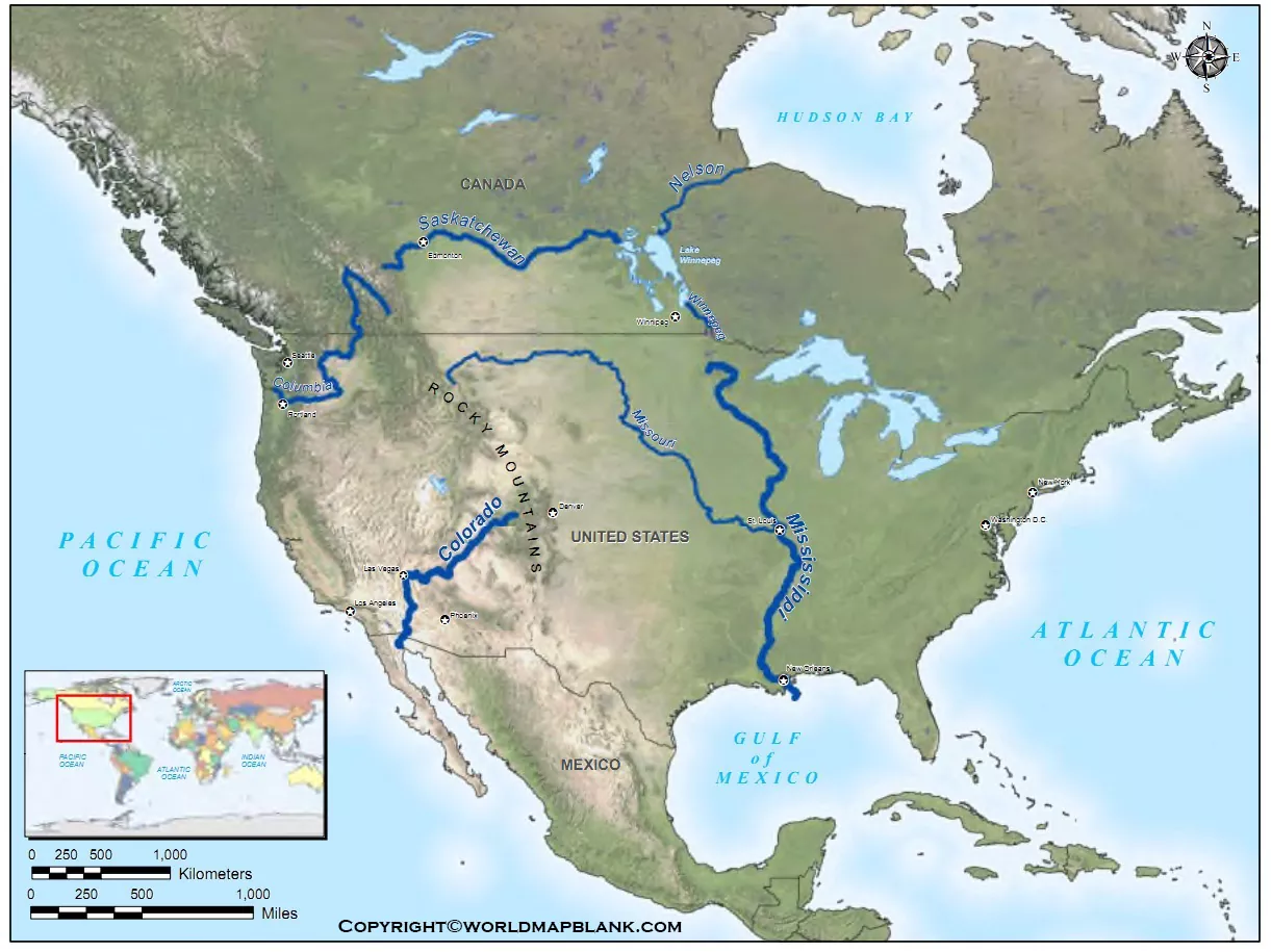
Rivers of North America Map: Exploring the Continent's Waterways
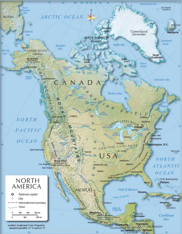
North America boasts a vast and intricate network of rivers, shaping landscapes, supporting ecosystems, and influencing human settlement for millennia. Understanding the rivers of North America map is crucial for geographers, environmental scientists, historians, and anyone interested in the continent's natural history. This article will delve into the major river systems, their significance, and offer insights into their current state.
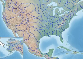
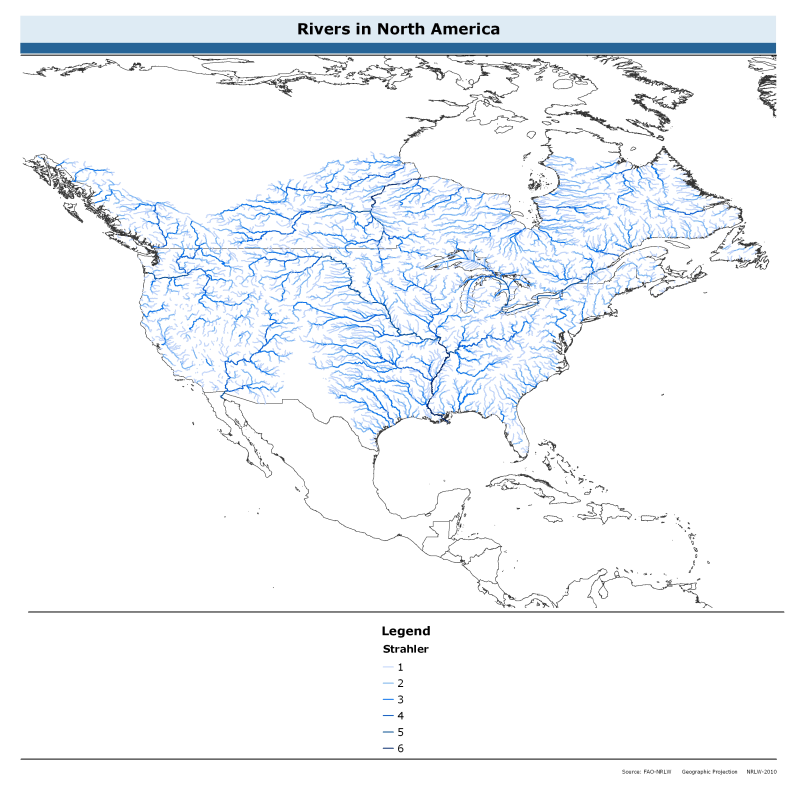
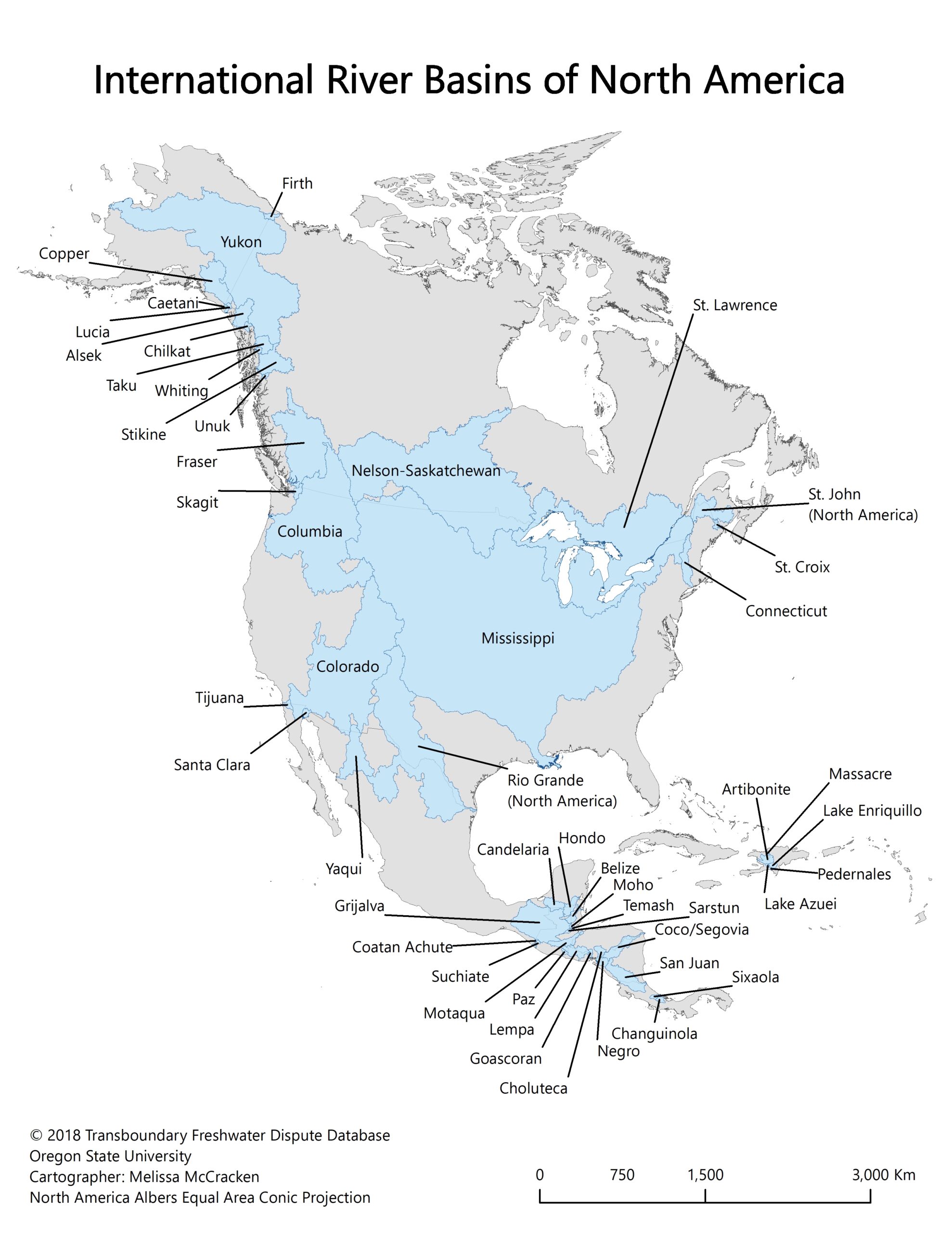
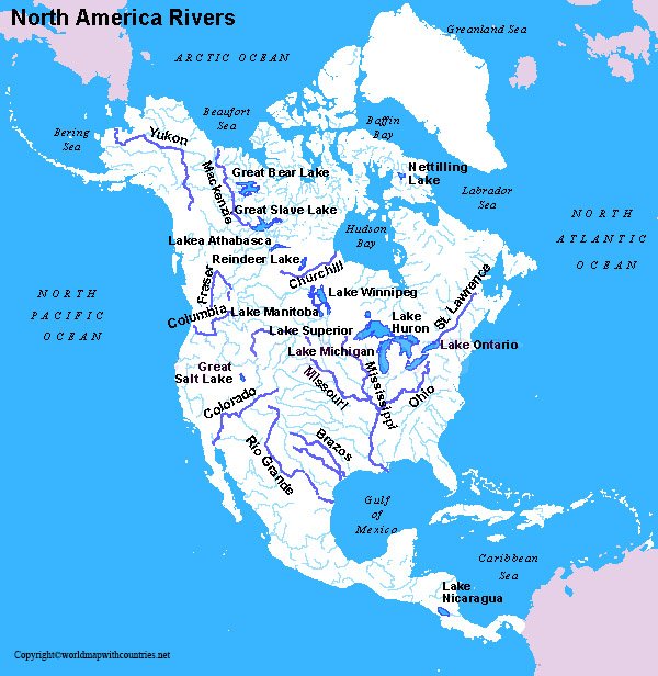
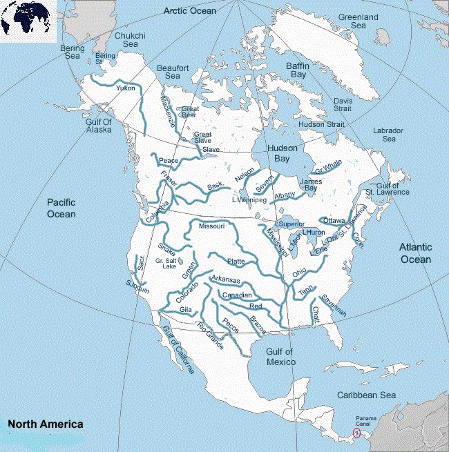
Caption: A detailed map showcasing the extensive river systems across North America, highlighting their geographical distribution and interconnectedness.
Rivers of North America Map: Major River Systems and Their Significance
Several river systems dominate the North American landscape. Let's explore some of the most prominent:
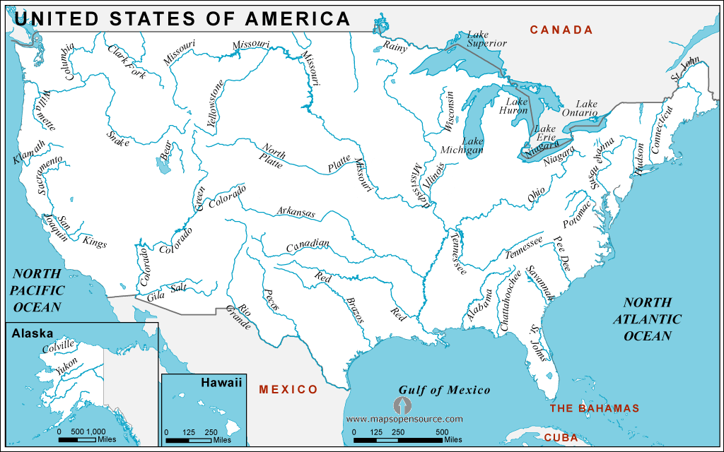
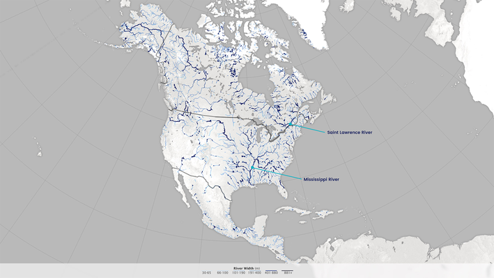
- The Mississippi River System: Arguably the most important, the Mississippi River drains a massive portion of the United States. Its tributaries, including the Missouri and Ohio Rivers, extend its reach across numerous states. This system is vital for navigation, agriculture, and industry. The Mississippi River is known for its extensive floodplains and delta region, which supports diverse wildlife.
- The Missouri River: The longest river in North America, the Missouri is a major tributary of the Mississippi. It flows through the Great Plains and played a crucial role in westward expansion during the 19th century. Today, it's still important for irrigation and hydroelectric power.
- The Colorado River: This river is a lifeline for the arid Southwest. It provides water for major cities like Los Angeles, Phoenix, and Las Vegas. However, its water is heavily utilized, leading to concerns about its long-term sustainability and impacting the ecosystem of the Colorado River Delta.
- The Columbia River: Originating in the Canadian Rockies, the Columbia River flows through Washington and Oregon before emptying into the Pacific Ocean. It's a major source of hydroelectric power, with numerous dams along its course. It also supports a significant salmon fishery.
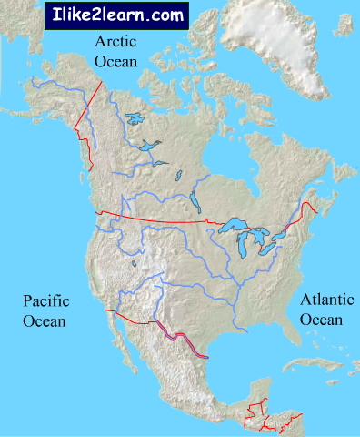
- The St. Lawrence River: Connecting the Great Lakes to the Atlantic Ocean, the St. Lawrence River is a crucial shipping route. It forms part of the border between Canada and the United States and is essential for trade and commerce.
- The Mackenzie River: The longest river system in Canada, the Mackenzie flows northward into the Arctic Ocean. It drains a vast area of the Northwest Territories and is important for transportation and resource extraction in the region.
Caption: The mighty Mississippi River winding through the American heartland, a testament to its historical and contemporary importance.
Rivers of North America Map: Impact of Rivers on Human Settlement
Rivers have profoundly shaped human settlement patterns in North America. Early civilizations relied on rivers for transportation, water supply, and agriculture. Many major cities, like New Orleans, St. Louis, and Montreal, are located along major rivers.
The availability of water resources has always been a determining factor in where people choose to live and cultivate land. Rivers also served as natural boundaries and strategic locations for defense.
Caption: A historical depiction of early settlers utilizing the Mississippi River for transportation and trade, highlighting its integral role in the development of the American frontier.
Rivers of North America Map: Environmental Challenges and Conservation
Many of North America's rivers face significant environmental challenges, including pollution, dam construction, and water depletion.
- Pollution: Agricultural runoff, industrial discharge, and urban stormwater contribute to water pollution, harming aquatic life and human health.
- Dam Construction: Dams alter river flow, disrupt fish migration, and can lead to habitat loss.
- Water Depletion: Overuse of water for irrigation and urban consumption can deplete river flows, particularly in arid regions.
Conservation efforts are crucial to protect these vital resources. This includes implementing stricter pollution control measures, restoring degraded habitats, and promoting sustainable water management practices.
Caption: A stark image of a polluted river, emphasizing the urgent need for environmental conservation and sustainable water management practices.
Rivers of North America Map: Current Trends and Future Outlook
The future of North America's rivers depends on how we manage these resources in the face of increasing demands and climate change. Trends to watch include:
- Climate Change: Changes in precipitation patterns and temperature could significantly impact river flows and water availability.
- Water Scarcity: As populations grow and demands increase, water scarcity will become an even greater challenge in many regions.
- Restoration Efforts: There's a growing movement to restore damaged river ecosystems and promote sustainable water management.
Addressing these challenges will require a collaborative effort between governments, businesses, and individuals.
Caption: A depiction of sustainable water management practices, emphasizing the importance of responsible resource utilization for future generations.
Rivers of North America Map: Question and Answer
Q: What is the longest river in North America? A: The Missouri River
Q: Which river is most important for agriculture in the Southwest? A: The Colorado River
Q: What are some of the major environmental challenges facing North American rivers? A: Pollution, dam construction, and water depletion.
Q: How has climate change impacted North American Rivers? A: Climate change could significantly impact river flows and water availability.
Q: Why are rivers of North America are important? A: Are crucial for geographers, environmental scientists, historians, and anyone interested in the continent's natural history.
Keywords: Rivers of North America Map, Mississippi River, Colorado River, Columbia River, St. Lawrence River, Mackenzie River, Water Resources, Environmental Conservation, River Systems, North American Geography, Water Pollution, Climate Change, Water Scarcity.


4 Free Labeled North America River Map In PDF Map Of North America Rivers 300x300 River Map Of US United States Maps Us River Map Rivers Of North America Original 8661343 3 North America Rivers Map Map Of North America With Rivers North America River Map Rivers Of North America CzyZbUsHIGiG0f1ptj62DQ B Future Map Of America 2025 Nadya Verena BRM4343 Scallion Future Map North America Text Right 2112x3000 North America Rivers Map Map Of North America With Rivers Map Of North America With Rivers Overview Graphic NORAMRIV Temp
4 Free Labeled North America River Map In PDF Map Of North America Rivers Labeled Rivers In North America North American Rivers Major Rivers In Canada 27b73651c82a527cf6c3925d56d7221f Fresh Water In Canada Labeled North America Rivers Map Fb1fcf3d438555bc5cc09228e9cbb5e8 Exploring The Rivers And Basins Of North America Vivid Maps American Rivers2 Scaled River Map Of North America US States Map 107270ea36fc7868d57dca7f97056a8d North America Lakes Map Winne Karalynn North America Rivers And Lakes North America Rivers Map Map Of North America Rivers Printable Image 314
Rivers Of North America Map Of North America Showing Rivers Major Settlements And Other Landmarks E0NWWD North America Rivers Map Map Of North America With Rivers NorthAmerica 2018 Full Scaled Free Printable Map Of North America Rivers In PDF Printable Map Of North America Rivers Major Rivers In America Map United States Map Buac35 Img Riverwidth Poster G06iZyF .resize.710x399 Rivers Of North America N America Water Rivers2 North America River Map Outline Rivers Featured Exploring The Rivers And Basins Of North America Vivid Maps North America Rivers 2032x2048
Map Of North America In 2025 By Rabbit Ice On DeviantArt Map Of North America In 2025 By Rabbit Ice Deon4kl Pre Map Of Usa And Rivers Imran Zoe Map.GIFNorth American Rivers Rivers Of North America Ilike2learn Mapes E9cc80b3 7f3c 3730 F9a1 585c6435a515 Labeled North America Rivers Map Facts%2Babout%2BMajor%2Band%2BImportant%2BRivers%2Bof%2BNorth%2BAmerica%2BContinent Python Maps On Twitter USA Rivers This Map Shows The Rivers Of The FqY 6wuWwAErDgw Future Map Of America 2025 Nadya Verena BRM4346 Scallion Future Map United States Lowres Scaled List Of Rivers Of The Americas Wikipedia 350px NorthAmerica WaterDivides
United States Map Of Rivers Usrivers.webpUs River Map With States 64cc721f8f6666a7f12ad70aa6fe3f85 PPT Surface Water PowerPoint Presentation Free Download ID 2014482 Major Rivers Of North America L