
Last update images today US Map With Capitals: Your Ultimate Guide
US Map with Capitals: Your Ultimate Guide
Navigating the USA: An In-Depth Look at the US Map with Capitals
Understanding the United States goes beyond just knowing its shape; it involves knowing its 50 states and their respective capitals. Whether you're a student, a trivia enthusiast, a traveler planning your next adventure, or simply curious about American geography, this guide offers a comprehensive exploration of the US map with capitals.
Why Understanding the US Map with Capitals Matters
Knowing the US map with capitals is more than just academic knowledge. It provides a framework for understanding American history, culture, economics, and politics. Consider this: the location of a state capital often reflects its historical significance or strategic importance. For instance, Albany, New York, was chosen for its central location along the Hudson River, vital for trade in the early days of the state. Likewise, understanding the geographical distribution of capitals can shed light on regional differences and economic hubs.
- Education: Essential for geography, history, and social studies classes.
- Travel: Helps with route planning and understanding regional characteristics.
- Civic Engagement: Fosters a greater understanding of the American political system.
- General Knowledge: Impresses your friends at trivia night!
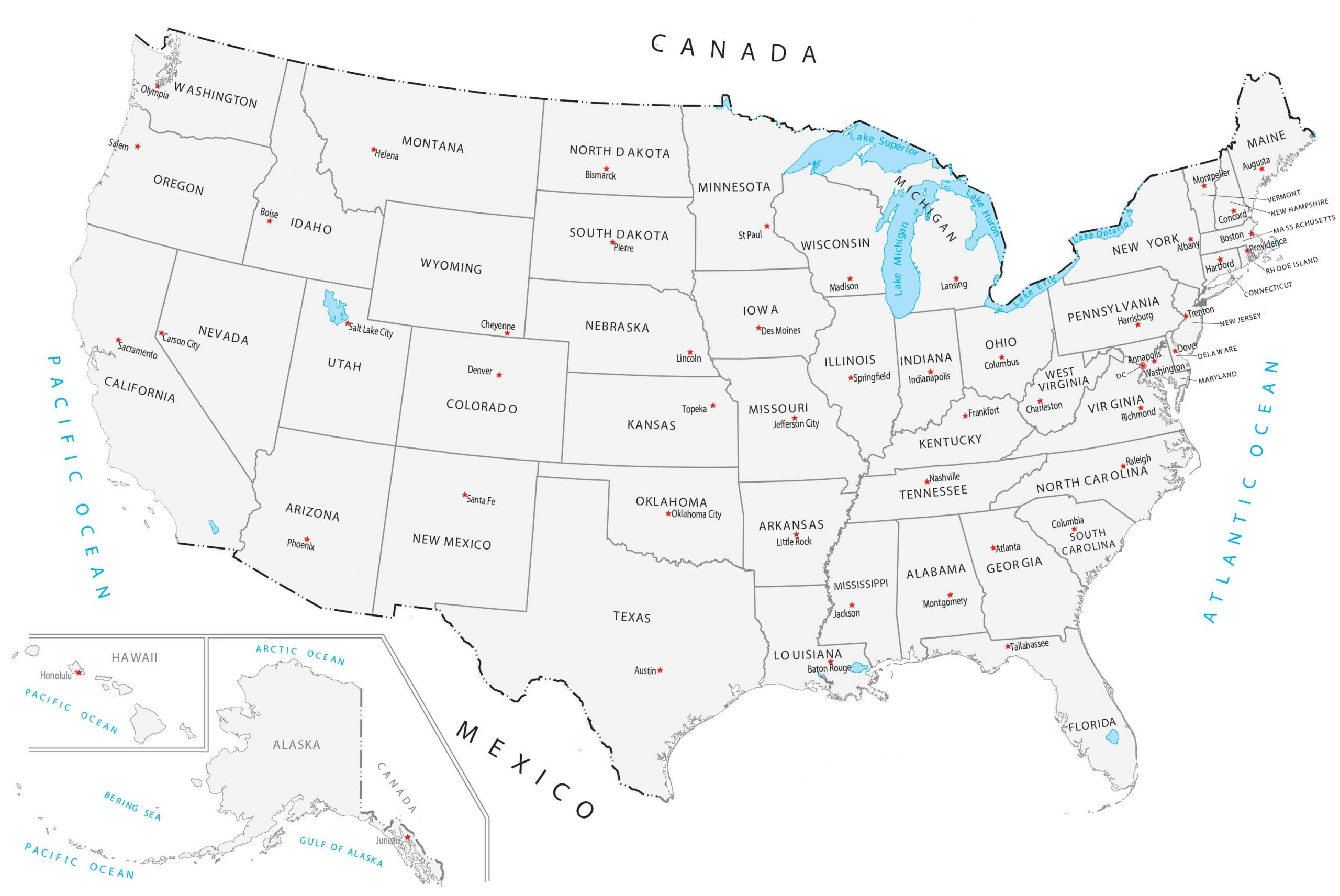
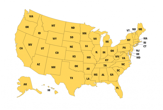
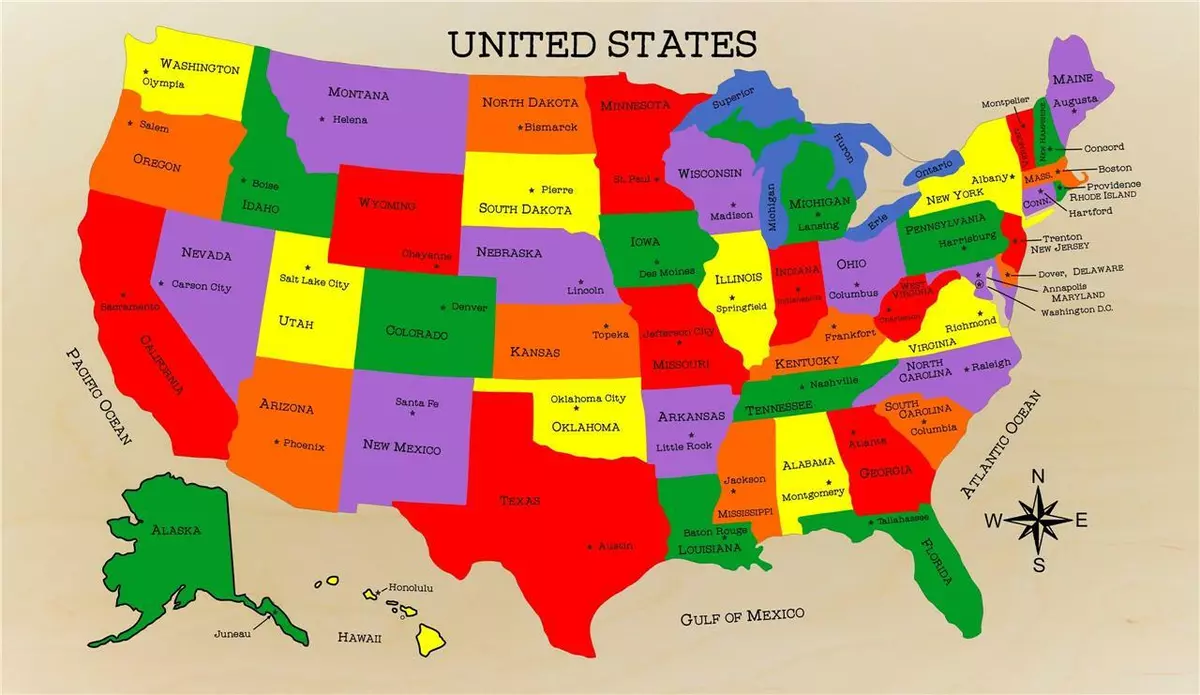
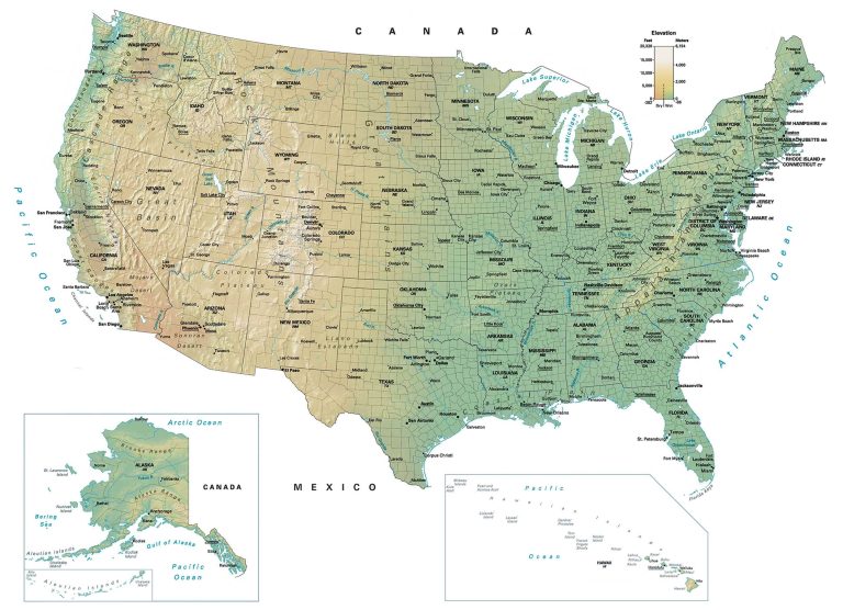
Alt Text: A vibrant US map showcasing the location of each state capital. Caption: A visual representation of the US, highlighting the importance of understanding the location of state capitals.
Diving Deep: The US Map with Capitals - State by State
Let's break down the US map with capitals region by region, starting with the Northeast:
-
Northeast: This region is rich in history and densely populated.
- Maine: Augusta
- Vermont: Montpelier
- New Hampshire: Concord
- Massachusetts: Boston
- Rhode Island: Providence
- Connecticut: Hartford
- New York: Albany
- Pennsylvania: Harrisburg
- New Jersey: Trenton
-
Midwest: The heartland of America, known for agriculture and industry.
- Ohio: Columbus
- Michigan: Lansing
- Indiana: Indianapolis
- Illinois: Springfield
- Wisconsin: Madison
- Minnesota: St. Paul
- Iowa: Des Moines
- Missouri: Jefferson City
- North Dakota: Bismarck
- South Dakota: Pierre
- Nebraska: Lincoln
- Kansas: Topeka
-
South: A region with a diverse cultural heritage and a warm climate.
- Delaware: Dover
- Maryland: Annapolis
- Virginia: Richmond
- West Virginia: Charleston
- Kentucky: Frankfort
- Tennessee: Nashville
- North Carolina: Raleigh
- South Carolina: Columbia
- Georgia: Atlanta
- Florida: Tallahassee
- Alabama: Montgomery
- Mississippi: Jackson
- Louisiana: Baton Rouge
- Arkansas: Little Rock
- Texas: Austin
- Oklahoma: Oklahoma City
-
West: A region of stunning landscapes and vast open spaces.
- Montana: Helena
- Idaho: Boise
- Wyoming: Cheyenne
- Colorado: Denver
- New Mexico: Santa Fe
- Arizona: Phoenix
- Utah: Salt Lake City
- Nevada: Carson City
- California: Sacramento
- Oregon: Salem
- Washington: Olympia
- Alaska: Juneau
- Hawaii: Honolulu
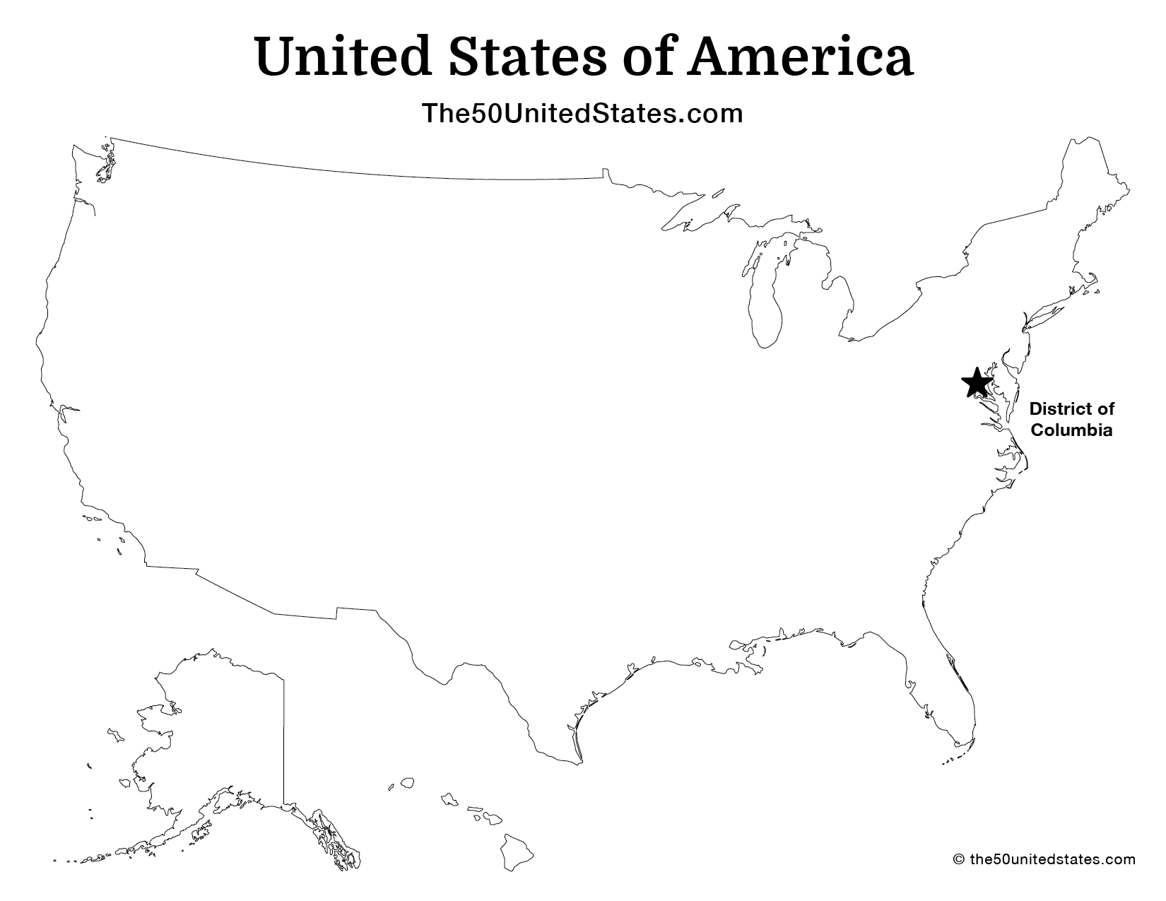
Alt Text: A detailed breakdown of the US map, categorized by region, with each state and its capital clearly labeled. Caption: Navigate the US with ease using this regional guide to state capitals.
Fun Facts and Interesting Insights About US Map with Capitals
- Smallest Capital: Montpelier, Vermont, is the smallest state capital by population.
- Most Populous Capital: Phoenix, Arizona, boasts the largest population among state capitals.
- State Capitals Not the Largest City: Many states have capitals that aren't their largest cities. For example, New York City is larger than Albany, and Los Angeles is larger than Sacramento.
- Capitals Named After Presidents: Jackson, Mississippi, is named after President Andrew Jackson.
- Unique Capital Placement: Juneau, Alaska, is only accessible by boat or plane, making it a truly unique capital city.
Tips for Memorizing the US Map with Capitals
Memorizing the US map with capitals can seem daunting, but with the right strategies, it can be an enjoyable challenge.
- Use Flashcards: Create flashcards with the state on one side and the capital on the other.
- Online Quizzes: Utilize online quizzes and interactive maps to test your knowledge.
- Mnemonics: Create memorable phrases or rhymes to associate states with their capitals.
- Regional Learning: Focus on learning the capitals region by region.
- Travel and Exploration: If possible, visit different states and their capitals to reinforce your learning.
Alt Text: Creative flashcards showcasing US states and their respective capitals. Caption: Flashcards are a great tool to memorize state capitals effectively.
The Future of Understanding the US Map with Capitals
In an increasingly digital world, the importance of understanding geography might seem less critical. However, a solid grasp of the US map with capitals remains essential for informed citizenship, effective communication, and a deeper understanding of the world around us.
Online learning tools and interactive maps are making it easier than ever to explore American geography. As technology evolves, we can expect even more innovative ways to learn about the US map and its capitals.
Question and Answer about US Map with Capitals
Q: Why is it important to know the US map with capitals?
A: Knowing the US map with capitals enhances understanding of American history, culture, economics, and political systems, aiding education, travel, civic engagement, and general knowledge.
Q: What is the smallest state capital by population?
A: Montpelier, Vermont.
Q: What is the most populous state capital?
A: Phoenix, Arizona.
Q: What are some tips for memorizing the US map with capitals?
A: Use flashcards, online quizzes, mnemonics, regional learning, and travel.
Q: Are state capitals always the largest cities in their states?
A: No, often state capitals are not the largest cities (e.g., Albany, NY, is not the largest in New York).
Q: What is unique about Juneau, Alaska?
A: It is only accessible by boat or plane.
In summary, understanding the US map with capitals is essential for a well-rounded education and informed citizenship. Through various learning methods and resources, anyone can master this fundamental knowledge. What are the benefits of knowing state capitals, and what are some effective memorization techniques? Keywords: US map with capitals, state capitals, American geography, learn US capitals, US geography quiz, US states, United States map, capitals of the United States, study US geography.


:max_bytes(150000):strip_icc()/capitals-of-the-fifty-states-1435160-final-842e4709442f4e849c2350b452dc6e8b.png)


United States Map With Capitals GIS Geography US States Map Feature 678x456 A Map Of The United States With Capitals Zahra Tatum United States Map Free Printable US States And Capitals Map Other Goodies The Facts Us State Capitals Blank Map 1.webpUnited States Map With Capitals GIS Geography US Capitals Map Scaled Carte USA Color E Avec Capitales Stratifi Maroc Ubuy 81mHiT9DhpL. AC SL1500 Capital Cities Of The United States WorldAtlas Shutterstock 36096514 2
State Maps Of The United States Eli Noor Usa State And Capital Map Usa Map With Capital City USA States Capital And Main Cities Map America Map 2025 Olva Tommie Redone The Second American Civil War 2025 2033 V0 Oo1ijpvgnadc1 Us Map In 2025 Brear Peggie 902025 Map Of The United States Blair Chiarra Hamiltons Legacy A Blessed United States In 2025 Election V0 R62fuiv0f5wc1 Capital Cities Of The United States WorldAtlas Us State Capitals 01 United States Map 2025 Addy Crystie BRM4343 Scallion Future Map North America Text Right 2112x3000 Us Senate 2025 Interactive Map Oliver Daniel J59o8gq
Map Of The US In 2025 By ThePandoraComplex141 On DeviantArt Map Of The Us In 2025 By Thepandoracomplex141 D3i23yw Fullview Usa Map With Capitals Shutterstock 36096514 2 States And Capitals Map Printable Cd0fa7a9ec28f658871bde1b6c13ba72 USA Political Map Of The United States Of US Map With Color 42 OFF 1000 F 536690638 SVzRrX42MXgwDfn73SRw4UeAqKYLF8b2 United States 2025 Future Fandom 250Capitals 2025 Drafttek Cindy Deloria Usa Map States Capitals Fefefe The Map Of The United States Of America With Capitals Carla Cosette S L1200.webp
Free Printable Map Of United States With Regions The 50 United States Map Usa Capital Label A Map Of The United States With Capitals Jackson Yaseen 50 States Capitals Final Printable Us Map With States And Capitals Labeled New Printable Map States And Capitals Of India 2024 28 States And 8 Union Territories Of India Map Capital 65cb10495b677 1568x882.webpThe 5 Regions Of The United States States And Capitals By The Double A Original 10899671 1 Wisconsin Michigan State Map Of Usa Usa Map States And Capitals U 8d2332487cf87634b868d4484e166b6d Current Map Of The United States Alejandra Skye United States Map With State Capitals Us Maps States Capitals 2cd8103261d7c0ecfefaffbf8a3f8b21 Map Of The United States And Its Capitals Samantha Brewis S Capitals Of The Fifty States 1435160 Final 842e4709442f4e849c2350b452dc6e8b
Printable Us Map With States And Capitals Cbfa6663ad252f3eb9b3a78feca96a0a United States 2025 Map Nancy Valerie USA United States Map With Capitals GIS Geography Map Of USA 768x556