
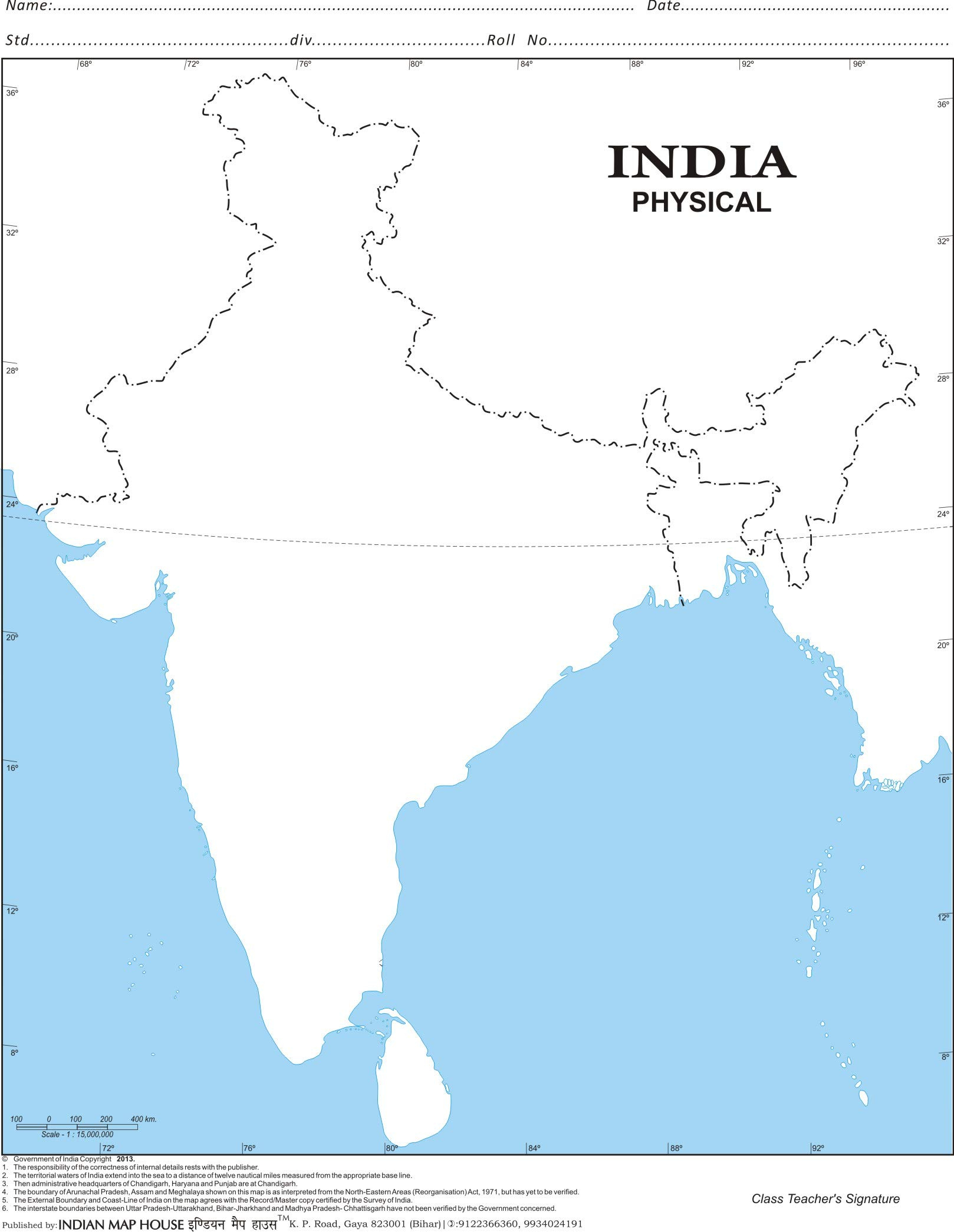
Last update images today Indias Majestic Landscapes: A Physical Feature Map
India's Majestic Landscapes: A Physical Feature Map
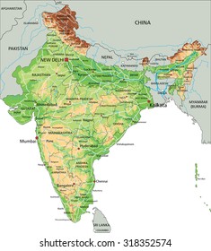
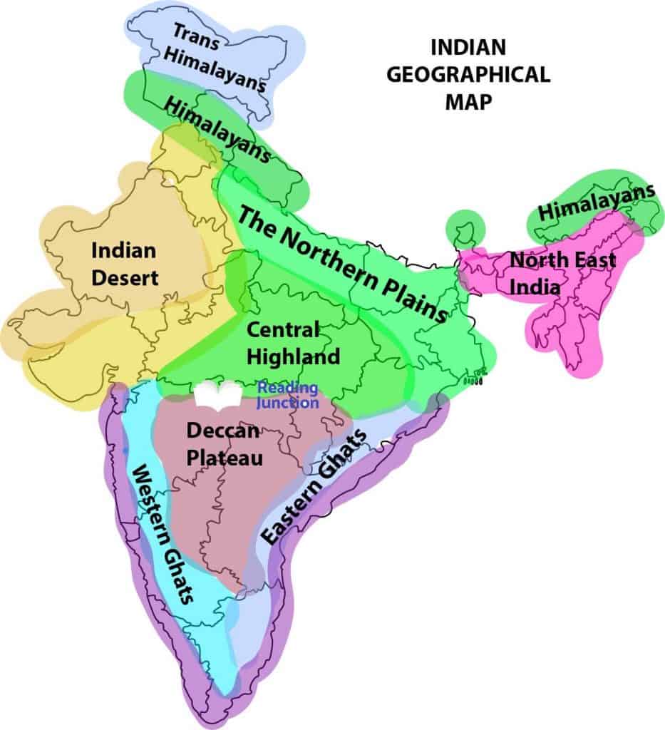
Introduction: Unveiling India's Diverse Terrain (Physical Feature Map of India)
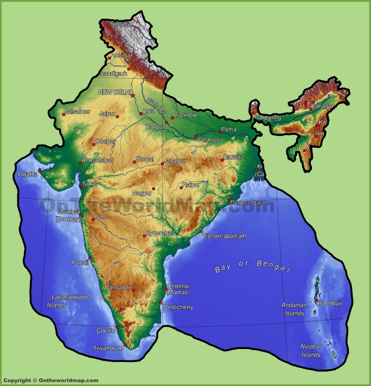
India, a land of vibrant cultures and rich history, boasts an equally diverse physical landscape. From the towering Himalayas to the expansive coastal plains, its geography plays a crucial role in shaping its climate, economy, and way of life. This article explores the physical features of India, providing a comprehensive overview for students, geography enthusiasts, and anyone curious about this fascinating country. Let's embark on a journey across India's stunning topography!
Target Audience: Students, geography enthusiasts, travelers, and anyone interested in learning about India's physical geography.
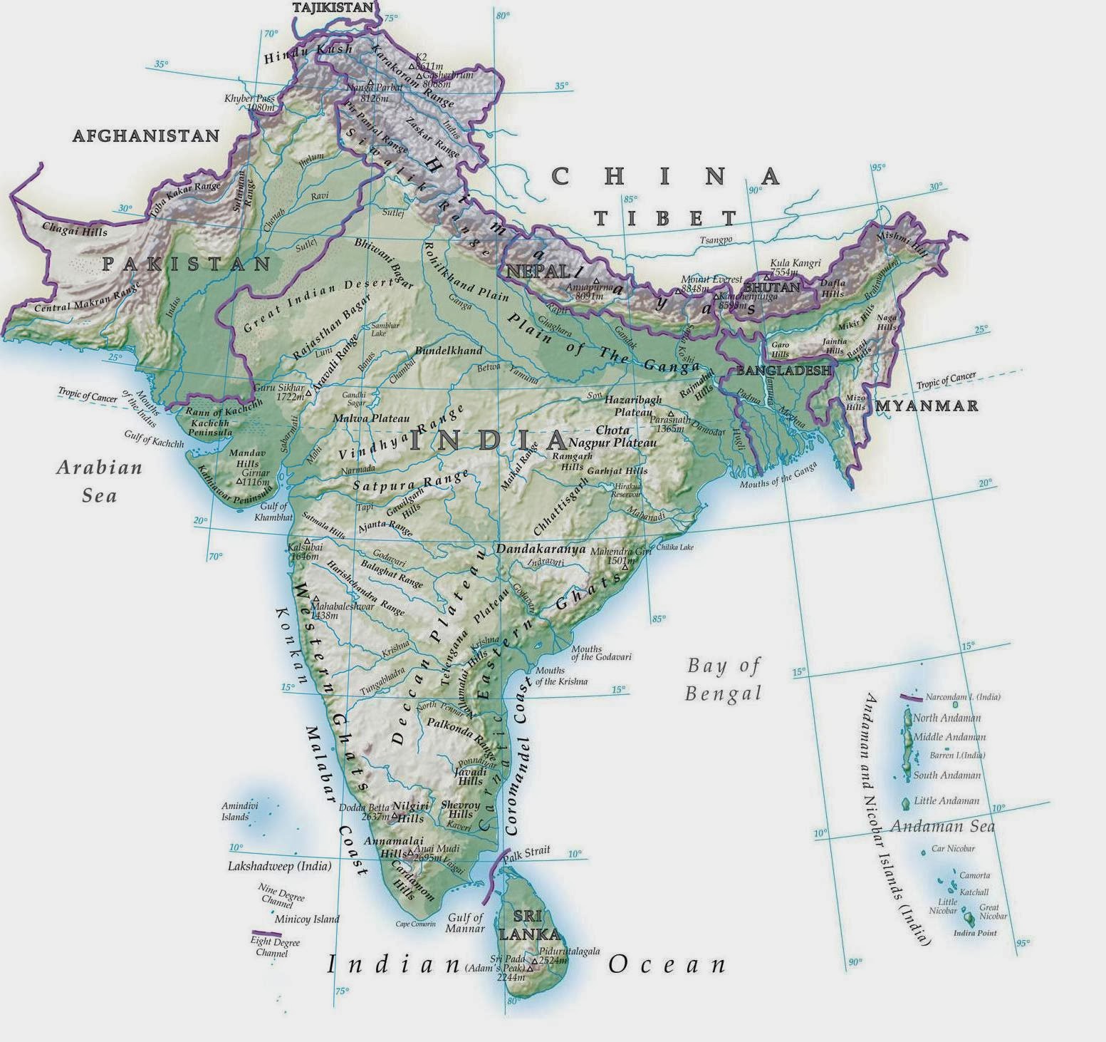
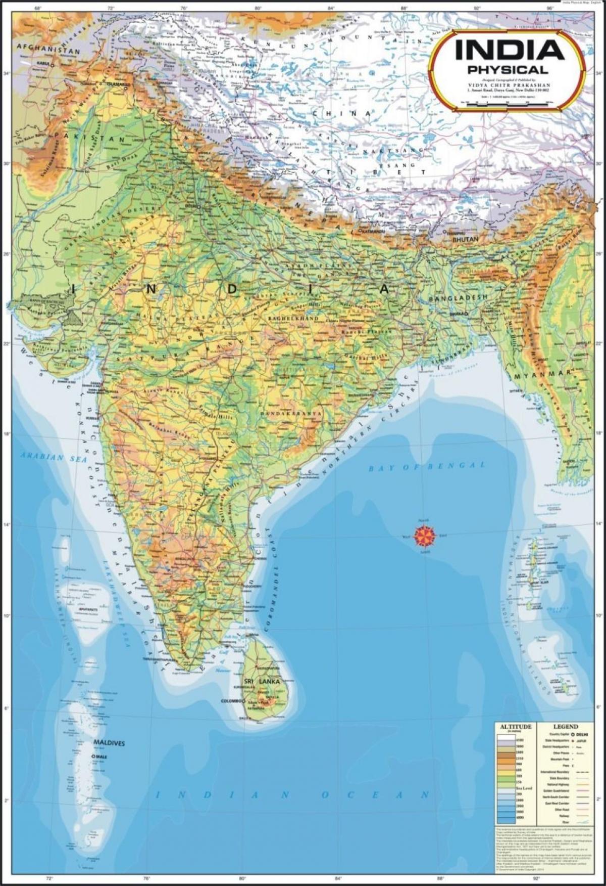
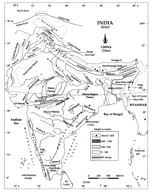
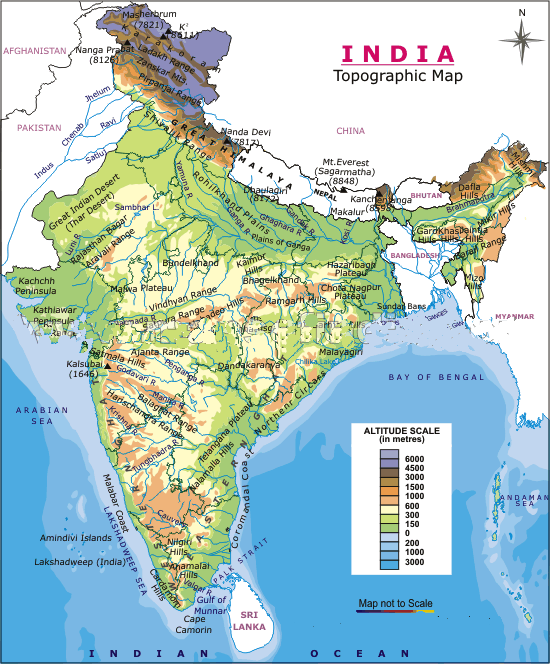
1. The Mighty Himalayas: India's Northern Sentinel (Physical Feature Map of India)
The Himalayas, meaning "abode of snow," form India's northern border. This young fold mountain range is not only a natural barrier but also a vital source of water for the Indo-Gangetic plains.
- Formation: Formed by the collision of the Indo-Australian and Eurasian plates.
- Key Features: High peaks (including Mount Everest, though not within India), deep valleys, glaciers (like the Gangotri), and dense forests.
- Divisions: The Himalayas are divided into:
- The Greater Himalayas (Himadri): Continuous range with the highest peaks.
- The Lesser Himalayas (Himachal): Rugged relief and valuable hill stations.
- The Outer Himalayas (Shiwaliks): The foothills, composed of unconsolidated sediments.
[Image of the Himalayas, capturing the snow-capped peaks and rugged terrain. ALT Text: Snow-capped Himalayan peaks, India.] Caption: The Himalayas, a majestic mountain range that defines India's northern border.
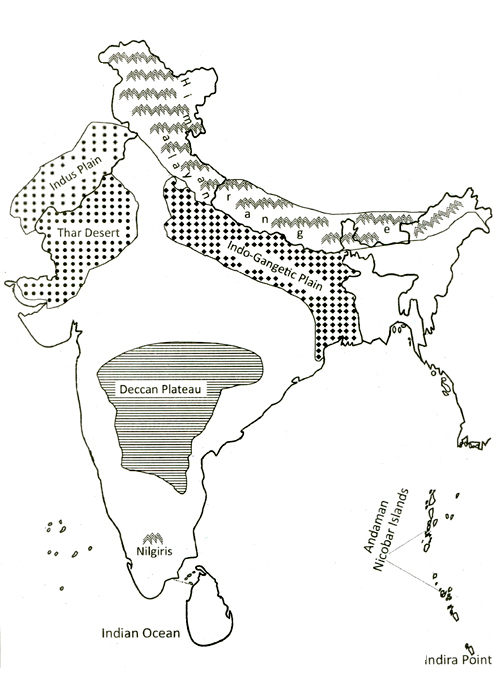
2. The Indo-Gangetic Plain: India's Fertile Heartland (Physical Feature Map of India)
South of the Himalayas lies the Indo-Gangetic plain, a vast, fertile alluvial plain formed by the Indus, Ganga, and Brahmaputra rivers and their tributaries.
- Formation: Depositional work of rivers flowing from the Himalayas.
- Key Features: Flat, fertile land ideal for agriculture, dense population, and a network of rivers.
- Divisions: Divided into:
- Bhabar: A narrow belt of pebbles and gravel.
- Terai: A marshy region south of Bhabar.
- Bangar: Older alluvial soil, less fertile.
- Khadar: Newer, more fertile alluvial soil.
- Significance: The 'food bowl' of India, supporting a large population and agricultural economy.
[Image of the Indo-Gangetic Plain, showcasing the fertile agricultural land. ALT Text: Fertile agricultural fields in the Indo-Gangetic Plain, India.] Caption: The Indo-Gangetic Plain, India's fertile heartland, sustained by a network of rivers.
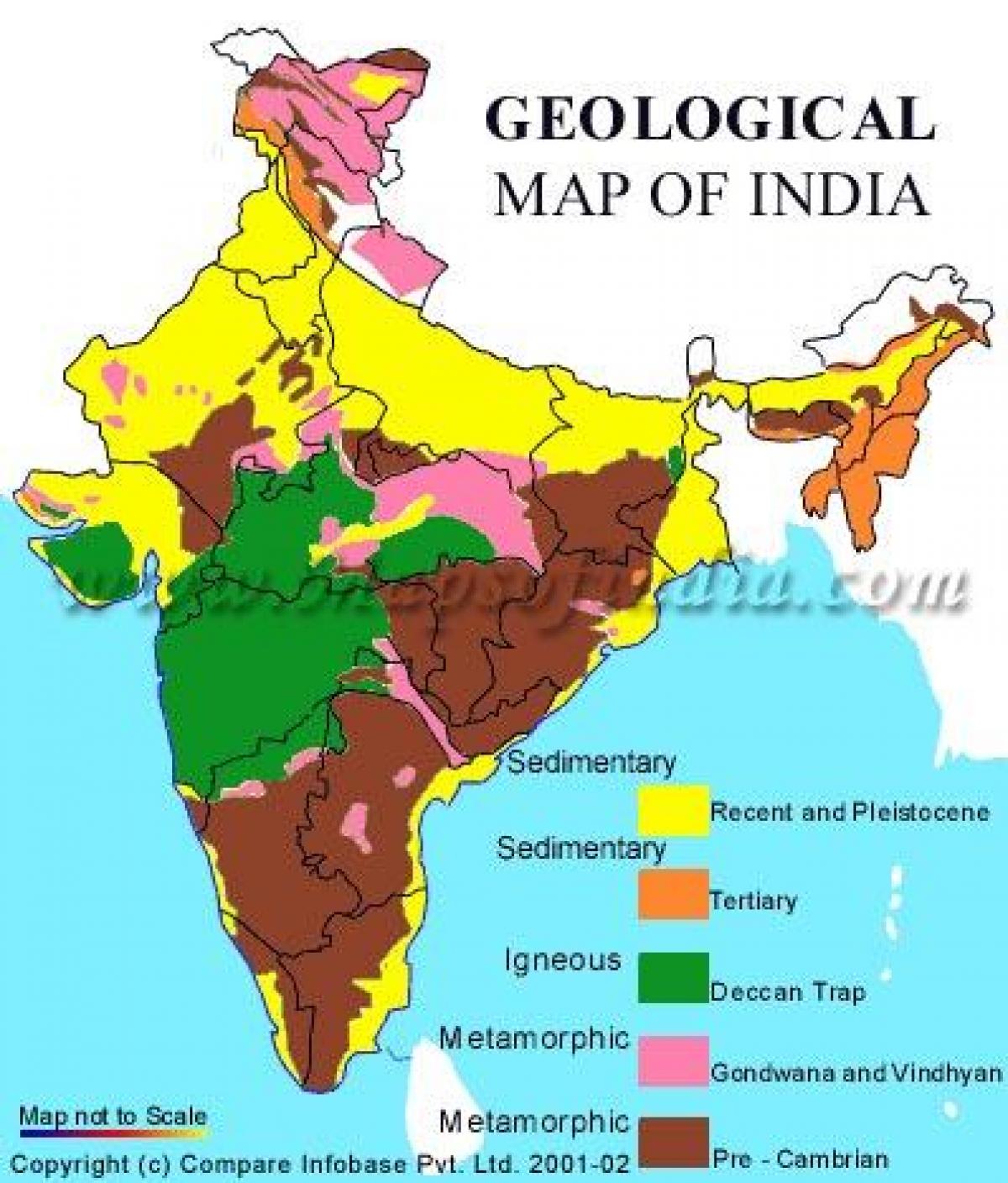
3. The Peninsular Plateau: India's Ancient Landmass (Physical Feature Map of India)
South of the Indo-Gangetic plain lies the Peninsular Plateau, an ancient tableland composed of igneous and metamorphic rocks.
- Formation: One of the oldest landforms on Earth.
- Key Features: Broad and shallow valleys, rounded hills, black soil regions (Deccan Trap), and mineral resources.
- Divisions: Divided into:
- The Deccan Plateau: Bounded by the Western and Eastern Ghats.
- The Central Highlands: Including the Aravali range, the Vindhya range, and the Chota Nagpur Plateau.
- Significance: Rich in minerals, provides a diverse range of agricultural products and supports industries.
[Image of the Peninsular Plateau, highlighting the rocky terrain and varied landscapes. ALT Text: Rocky terrain and diverse landscapes of the Peninsular Plateau, India.] Caption: The Peninsular Plateau, an ancient landmass rich in minerals and varied landscapes.
4. The Coastal Plains: India's Maritime Borders (Physical Feature Map of India)
India has extensive coastal plains along the Arabian Sea (west) and the Bay of Bengal (east).
- Formation: Formed by the depositional work of rivers and wave action.
- Key Features: Fertile soil, lagoons, backwaters, ports, and fishing industries.
- Divisions:
- The Western Coastal Plain: Narrower than the Eastern Coastal Plain, with features like the Konkan Coast, Malabar Coast, and lagoons.
- The Eastern Coastal Plain: Broader and more fertile, with deltas formed by major rivers like the Mahanadi, Godavari, Krishna, and Kaveri.
- Significance: Important for trade, fishing, tourism, and agriculture.
[Image of the coastal plains of India, showing the beaches, backwaters, and port cities. ALT Text: Beaches, backwaters, and port cities along the coastal plains of India.] Caption: India's coastal plains, vital for trade, fishing, and tourism.
5. The Indian Desert: The Arid West (Physical Feature Map of India)
The Indian desert, also known as the Thar Desert, lies to the west of the Aravali hills.
- Formation: Arid climate and sandy soils.
- Key Features: Sandy plains, sand dunes, low rainfall, and extreme temperatures.
- Significance: Despite its harsh conditions, the desert supports a unique ecosystem and traditional way of life. Efforts are being made for afforestation and irrigation to improve its productivity.
[Image of the Thar Desert, showing the sand dunes and arid landscape. ALT Text: Sand dunes and arid landscape of the Thar Desert, India.] Caption: The Thar Desert, a unique ecosystem adapted to harsh conditions.
Conclusion: A Land of Geographical Wonders (Physical Feature Map of India)
India's diverse physical features contribute significantly to its environmental, economic, and social fabric. Understanding these features is crucial for appreciating the country's rich heritage and addressing the challenges and opportunities it faces in the 21st century. From the majestic Himalayas to the fertile plains and the expansive coastlines, India's geography is truly remarkable.
Summary Questions and Answers
- Q: What are the major physical divisions of India?
- A: The Himalayas, the Indo-Gangetic Plain, the Peninsular Plateau, the Coastal Plains, and the Indian Desert.
- Q: What is the significance of the Himalayas?
- A: They act as a natural barrier, are a source of rivers, and influence the climate of India.
- Q: Why is the Indo-Gangetic Plain important?
- A: It is a fertile agricultural region supporting a large population.
- Q: What are the main features of the Peninsular Plateau?
- A: Ancient landmass rich in minerals, with broad and shallow valleys and rounded hills.
- Q: How are the Coastal Plains important to India?
- A: They facilitate trade, fishing, and tourism.
Keywords: Physical Features of India, India Geography, Himalayas, Indo-Gangetic Plain, Peninsular Plateau, Coastal Plains, Indian Desert, Indian Physical Map, India Landforms, Geography of India, India Terrain, India Landscape, Seasonal Geography, Informational Geography, India Travel, India Education, Map of India.


Physical Features Of India Map Map IndiaPhy India Physical Map Images Stock Photos Vectors Shutterstock High Detailed India Physical Map 260nw 318352574 Mapa Fisico De La India India Physical Map Max Physical Features Of India Map Poster Or Chart For Fo Vrogue Co Physical Features Of India 660 Full HD India Map HD PDF 2025 Free Download India Map HD PDF India Political And Physical Map Political And Physical Map Of India India Political And Physical Map Geography Map Of India Map India Physical Locator
Geological Map Of India India Map Geological Southern Asia Asia Geological Map Of India What Is Physical Features Of India 3 2 1 Physical Features Of Indian Map Image 11 Map Of India Physical Features World Map 4afdc0bdfcbd7cd042391cff2163bb29 India Physical Map Outline Adams Printable Map Physical Map Of India With Key India Map Physical Features India Physical Map India Physical Map Rivers And Mountains Topographic Map Of India
Official Physical Map Of India Physical Map India 600w 146218805 India Physical Features Sakshi Education India Physical Features Physical Features Of India Vrogue Co Download India Geographical Map 933x1024 Physical Feature Of India Map Map Print 186226465 India Physical Map 2022 Physical Map Of India Physical Features Of India Map Mountain Ranges Mountain Peaks Class 9 Geography Maps My Hand Made 2020 16 Physical Features Of India Diagram Quizlet .ivLML4oJ52E4bgaUD0Mlg B
Buy EKDALI Learn Physical Features Of India Physical Of India Wall 71jz0FhS2IL Physical Map Of India India Map Physical Map Geography Map OhTheme India Physical Map Indian People Physical Characteristics 507ffda00a0097e7dfd477920d89b19b India Physical Map Rivers And Mountains Class 9 Geography Map Work Chapter 2 Physical Features Of India 0 India Physical Map Physical Map Of India India Map Rainy Weathers Highly Detailed Physical Map Of Indiain Vector Formatwith All The Relief Formsregions And Big Cities 2J7GKFN Physical Map Of India With Rivers Mountains And Deserts United States Map Physical Map India India Map In 2050 Maxresdefault
India Physiographic Map A0abf6a7b7c799087c4552a8dcf91e61 Social Science Class 9 Introduction Physical Features Of India Map Of India Displaying Geographic Regions As Affecting Its Bio Diversity Teachoo