
Last update images today US Jet Stream Map: Your Weather Guide
US Jet Stream Map: Your Weather Guide
The US jet stream map is a vital tool for understanding and predicting weather patterns across North America. This article delves into what the jet stream is, how it impacts our weather, and how to interpret jet stream maps for seasonal weather predictions.
Understanding the US Jet Stream Map: What is the Jet Stream?
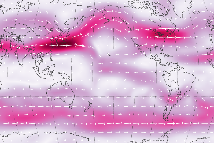
The jet stream is a high-altitude, fast-flowing air current found in the upper troposphere, the lowest layer of Earth's atmosphere. These "rivers of wind" are driven by temperature differences between the poles and the equator. The greater the temperature difference, the stronger the jet stream.
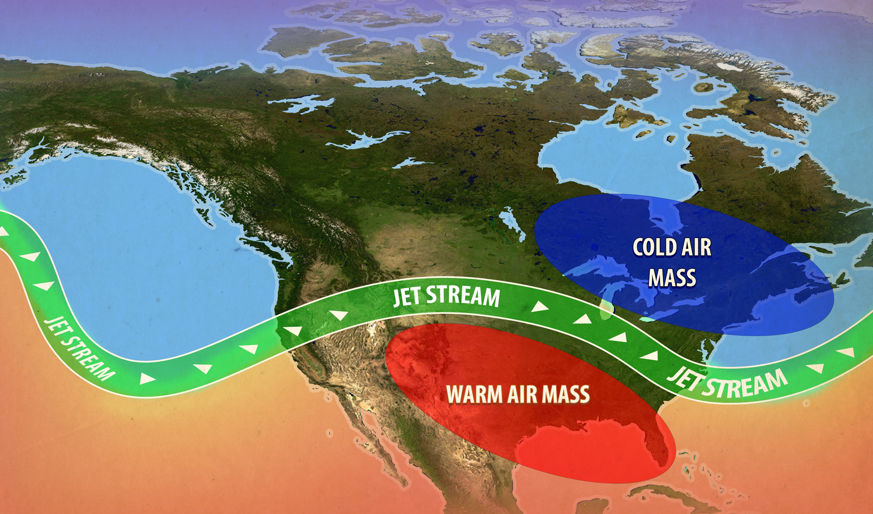
- Polar Jet Stream: Primarily affects the United States, bringing cold air masses from the Arctic southwards.
- Subtropical Jet Stream: Lies further south and can bring moisture and warm air northward.
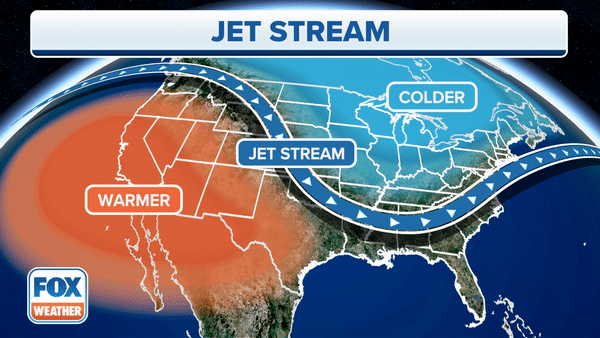
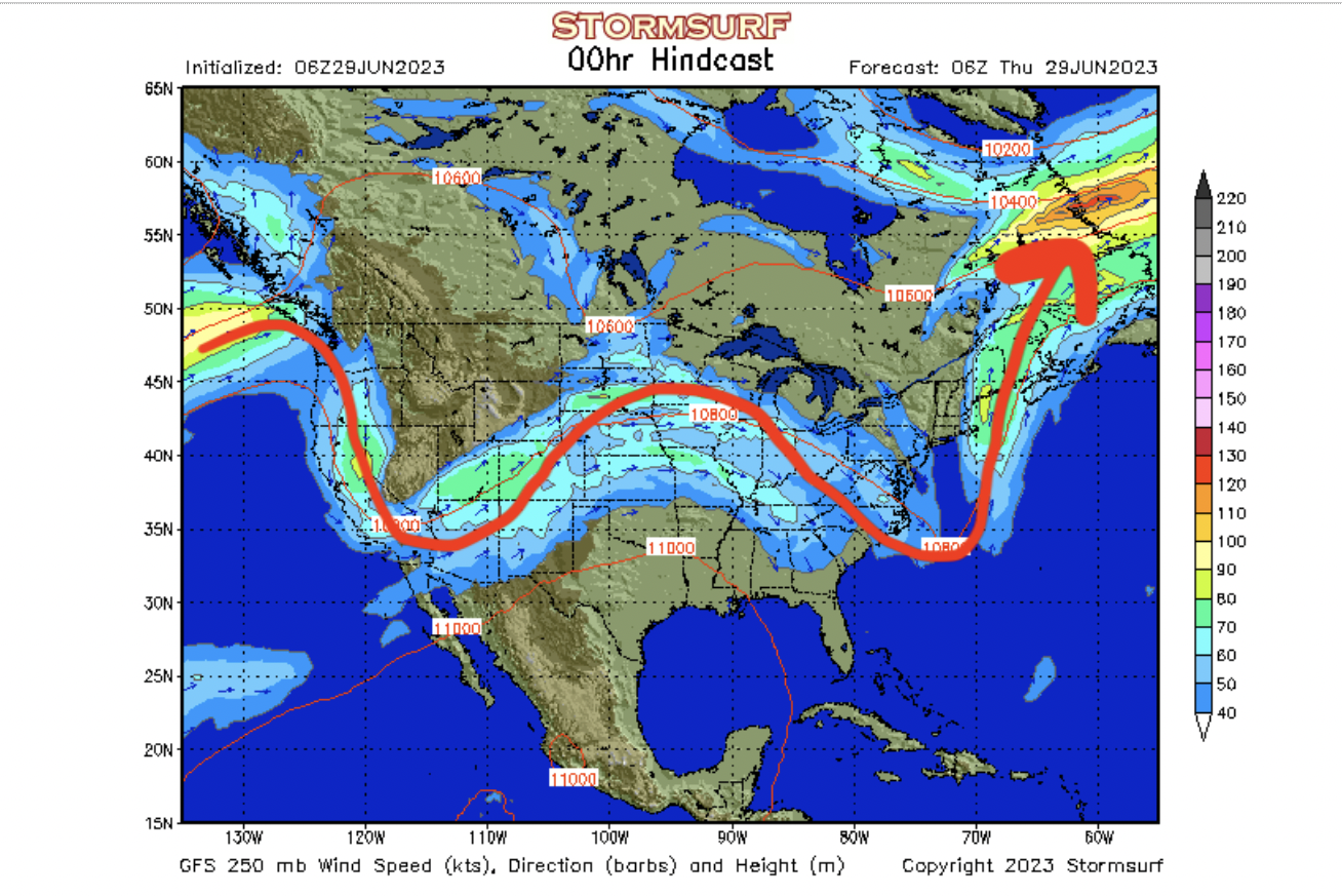
Caption: A visual representation of the jet stream's wavy path across the United States.
The US Jet Stream Map's Impact on Weather Patterns
The position and strength of the jet stream have a significant impact on weather patterns:
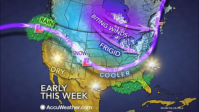
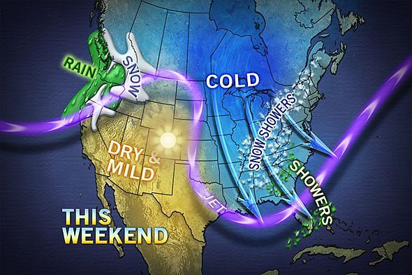
- Storm Tracks: The jet stream acts as a guide for storms, influencing their direction and intensity.
- Temperature: A jet stream dipping southwards brings colder temperatures, while one moving northwards brings warmer air.
- Precipitation: The jet stream's position can affect the amount and type of precipitation, leading to rain, snow, or drought conditions.
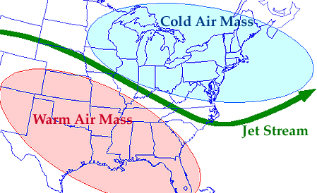
Decoding the US Jet Stream Map: Interpreting the Data
Interpreting a jet stream map requires understanding a few key elements:
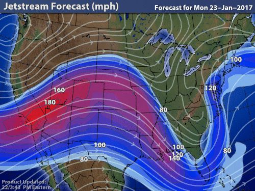
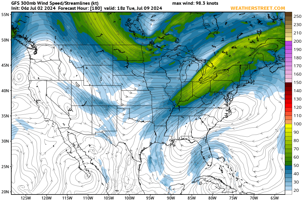
- Wind Speed: Indicated by color-coded scales or contours, showing the intensity of the jet stream.
- Direction: Arrows or lines show the direction of the airflow.
- Position: A northward position generally brings warmer weather, while a southward dip can indicate colder conditions.
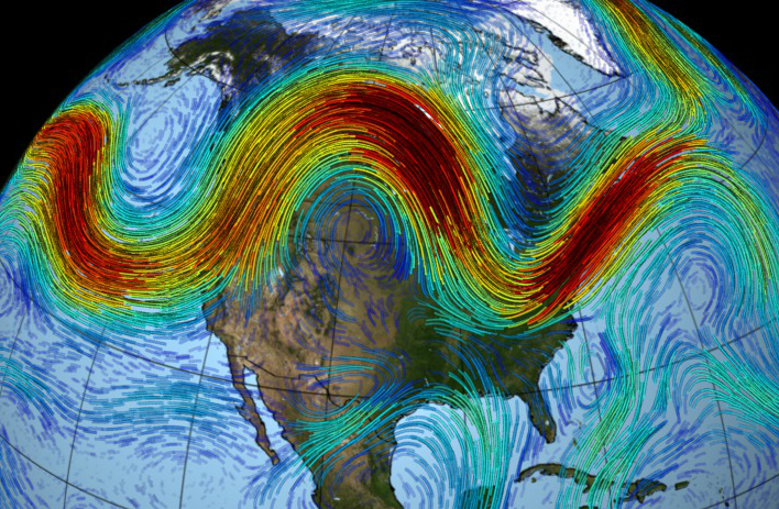
- Waves (Ridges and Troughs):
- Ridges: Bulges of the jet stream towards the poles, associated with high pressure and stable weather.
- Troughs: Dips of the jet stream towards the equator, associated with low pressure and stormy weather.
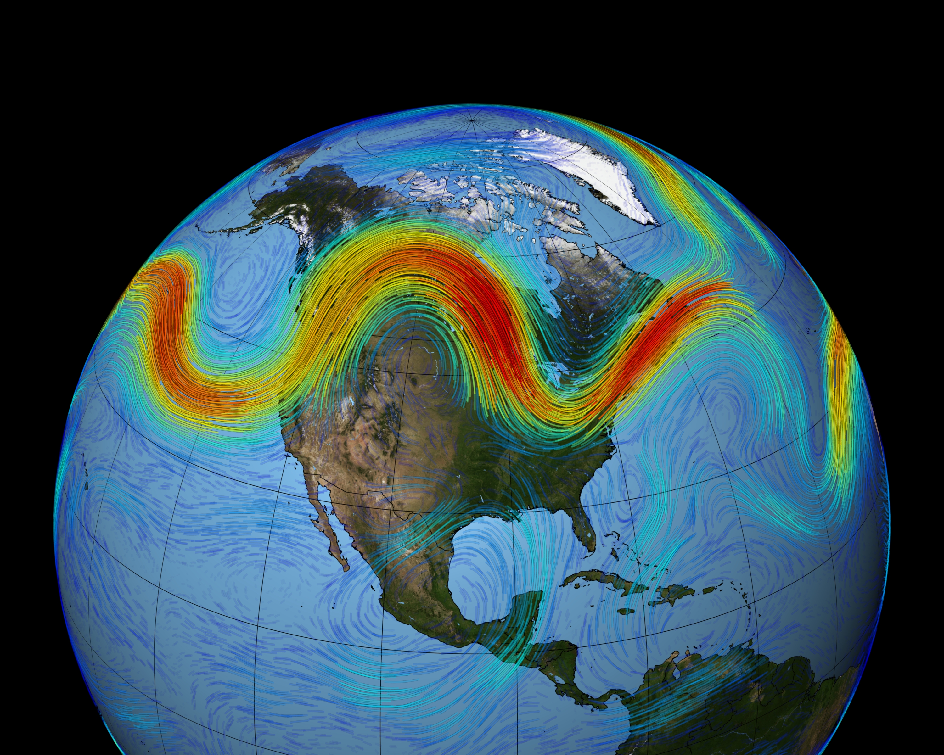
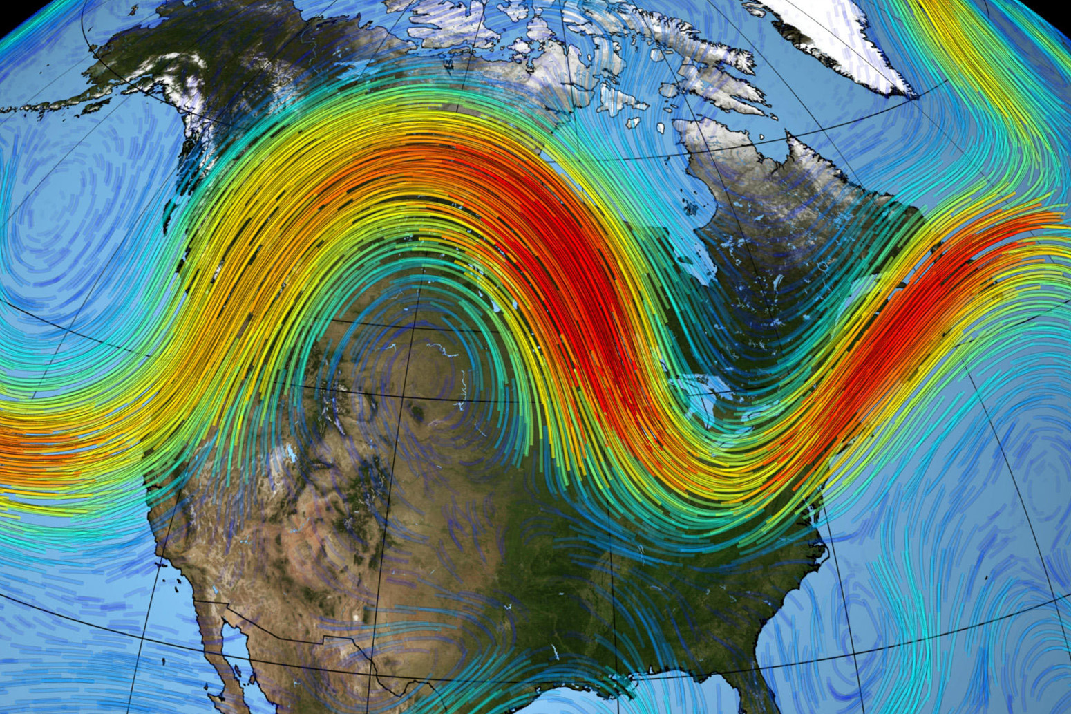
Caption: A closer look at the US jet stream map, highlighting wind speed, direction, and the presence of ridges and troughs.
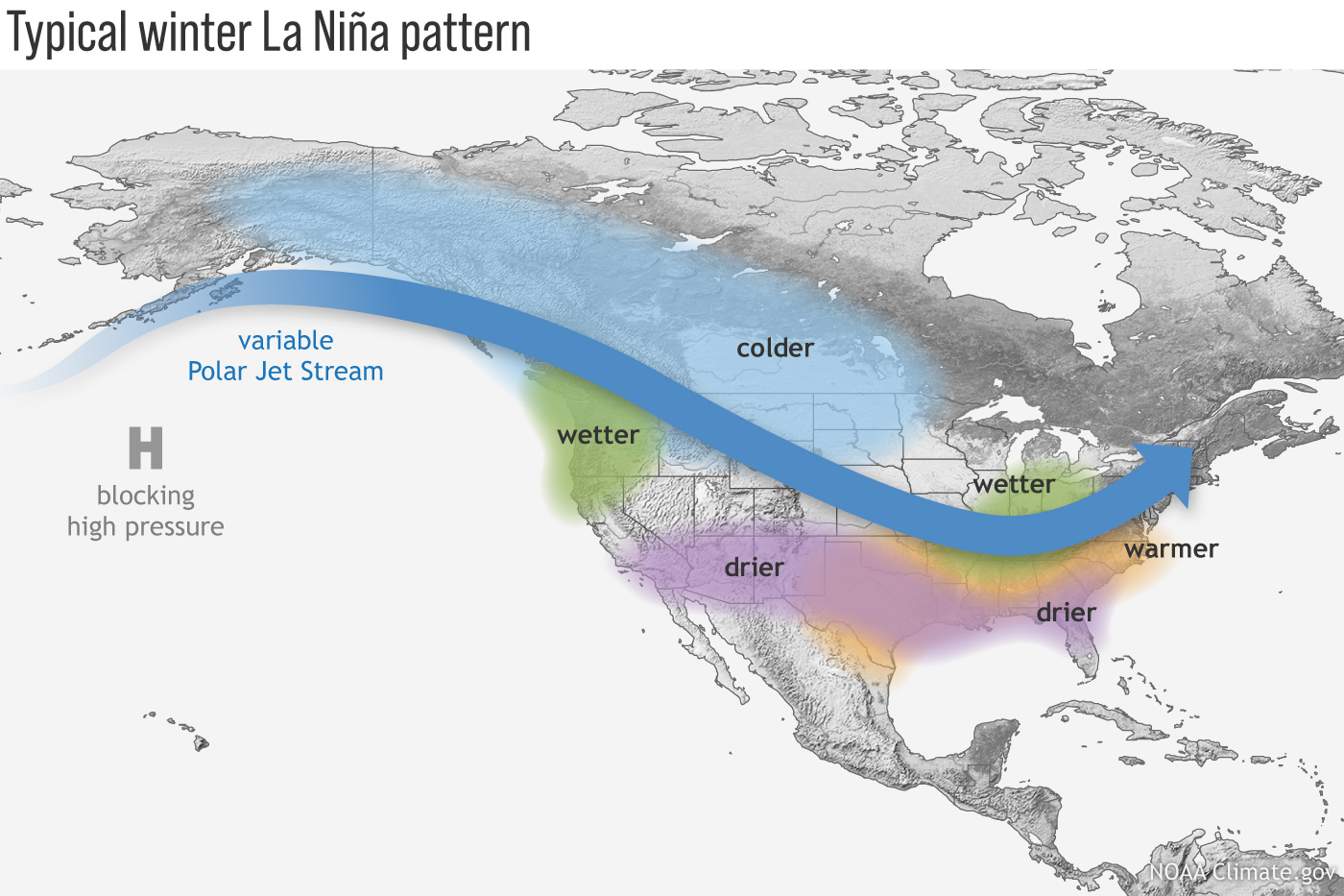
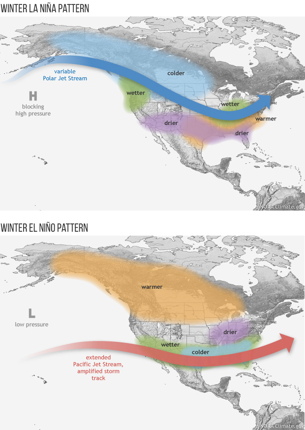
Seasonal US Jet Stream Map Variations and Predictions
The jet stream's behavior changes with the seasons, impacting weather patterns differently:
- Winter: The jet stream is typically stronger and located further south, bringing colder temperatures and increased storm activity to the southern US.
- Summer: The jet stream weakens and moves northward, resulting in warmer temperatures and reduced storm activity in the southern US.
- Spring & Fall: Transitional seasons where the jet stream gradually shifts, leading to fluctuating weather patterns.
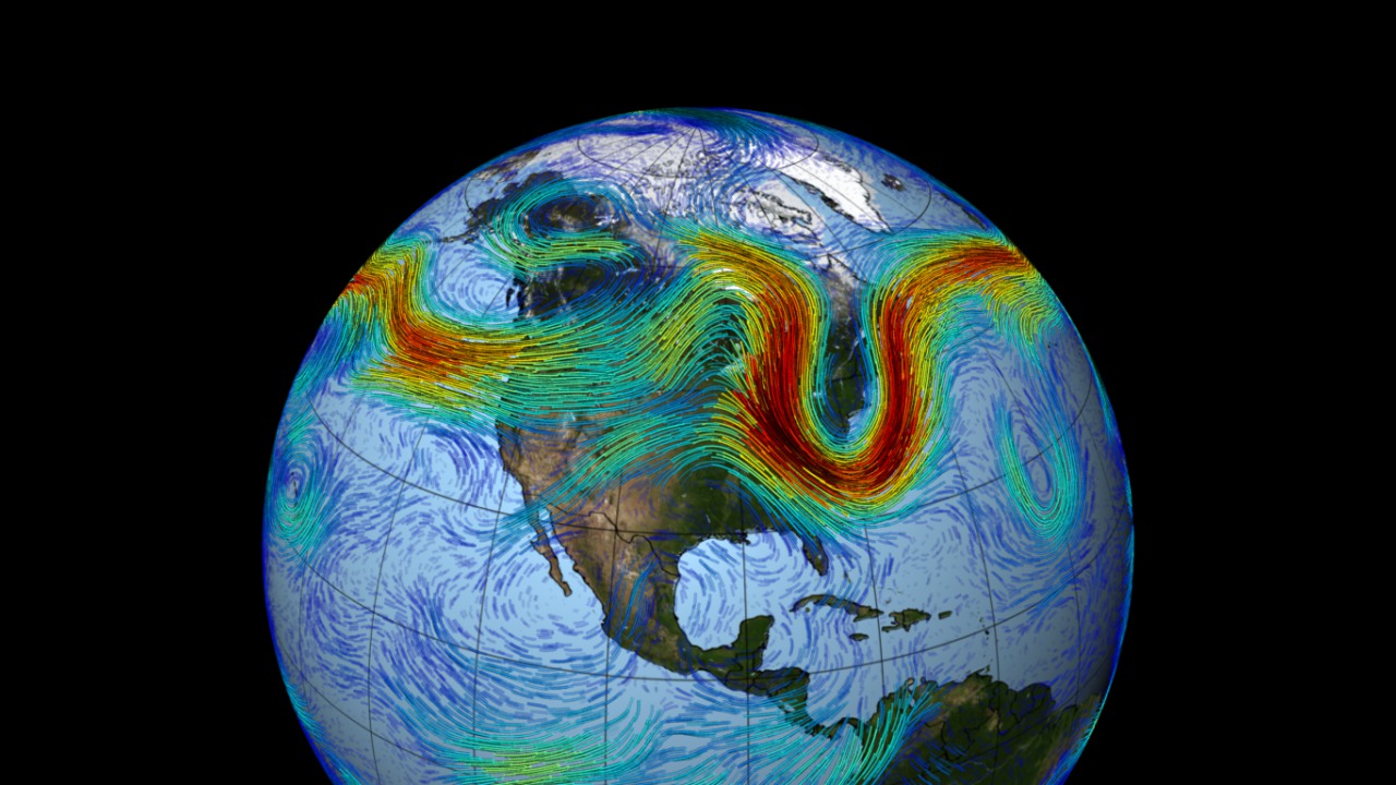
Caption: Seasonal variations of the jet stream, showing its position in winter and summer.
Practical Applications of Understanding the US Jet Stream Map
Understanding the jet stream map can be valuable for:
- Farmers: Planning planting and harvesting based on predicted weather patterns.
- Travelers: Anticipating travel delays due to storms or extreme weather.
- Outdoor Enthusiasts: Planning activities based on temperature and precipitation forecasts.
- Emergency Management: Preparing for severe weather events such as blizzards or heat waves.
Tools and Resources for Monitoring the US Jet Stream Map
Several online resources provide real-time jet stream maps:
- National Weather Service (NWS): Offers comprehensive weather data, including jet stream information.
- Aviation Weather Center (AWC): Provides detailed jet stream maps for aviation purposes.
- Various weather websites and apps: Offer user-friendly interfaces for monitoring the jet stream.
The Future of US Jet Stream Map and Weather Prediction
Climate change is influencing the jet stream, potentially leading to more extreme and unpredictable weather patterns. Scientists are using advanced models to better understand these changes and improve weather forecasting.
- Q: What is the jet stream?
- A: A high-altitude, fast-flowing air current that influences weather patterns.
- Q: How does the jet stream affect weather?
- A: It guides storms, influences temperature, and affects precipitation.
- Q: Where can I find jet stream maps?
- A: On the National Weather Service website, Aviation Weather Center website, and various weather apps.
Keywords: US Jet Stream Map, Jet Stream, Weather Patterns, Weather Prediction, Polar Jet Stream, Subtropical Jet Stream, Winter Weather, Summer Weather, National Weather Service, Aviation Weather Center.
Summary: This article explains the US jet stream, its impact on weather, how to interpret jet stream maps, seasonal variations, and resources for monitoring it. Q: What is the jet stream? A: A high-altitude wind current affecting weather.


:max_bytes(150000):strip_icc()/GettyImages-532103359-5b846575c9e77c007b87eea1.jpg)


Map Of Us Jet Stream Amanda Marigold Jet Stream Long Range Jet Stream Forecast Shows Early Spring Like Weather Pattern Jetstream Jet Stream Shift To Bring Big Changes For Large Swaths Of The US 1680773428694 040623 PATTERN CHANGE NASA SVS The Polar Jet Stream Jet Stream Print Res Jet Streams Jet Streams The Polar Front 01050805 169377 Jet Stream 2Different JetStreams What Are Jet Streams And How Do They Influence The Weather We Static Three Maine Jet Stream Branches 2
Maps Catalog Weather Underground Thumbnail The Jet Stream An Overview In Geography GettyImages 532103359 5b846575c9e77c007b87eea1 What Is A Jet Stream Live Science KWTaTyXhsqqXkXCji9v8kC 1200 80 Jet Stream Map AFP CV Chart Jet Stream Weather 101 Jet Streams Zonal JetStream Current Jet Stream Map United States Cinda Delinda Ezgif.com Video To Gif 2 NASA SVS The Polar Jet Stream Jetstream.00600
Jetstream Current And Forecast Gfs Uv300 Us 31 Weather 101 Jet Streams Meridional JetStream Study The North Atlantic Jet Stream Could Move By 2060 World VARqciU8BFCO7fSws2KDXW URR1Sm ALR0snrws1R K Polar Vortex How The Jet Stream And Climate Change Bring On Cold Snaps Jet Stream Na Nasa Jet Stream Ninos Ninafirst 620 Current Weather Map Jet Stream LaNina Winter Flat 1400x933 Jet Stream Map Photos And Images Stock Photo High Resolution Weather Map Showing The Jet Stream Flow Between North America And Europe 2247916021
Jet Stream NOAA Climate Gov ENSOBlog Jetstream Rotator 700 Current Jet Stream Map United States Cinda Delinda Static Winter Jet Stream Example 1 Current Us Wind Map Map Of Rose Bowl JET STREAM FLIGHT AWARE Intellicast Jet Stream In United States Weather Underground Wind B141c6a4ade53ea91c16dc073e9cd8f4 Jets Weather Climate Change Projections Permaculture Design Tools For Climate Figure 27 The Normal Course Of The Northern Hemisphere Jet Stream 0522 Jet Stream PDF Jet Stream Jet Stream And Its Types Geography Notes Online Jet Stream 300x200 WinnCad Elements Blog NASA Takes A Look At The Jet Stream Jet 2
Jet Stream In United States Wind Map Weather Patterns Weather Add076b1a2084f8ebc4bbfab3959df34 Jets United States Jet Stream Is Climate Change Causing More Blocking Weather Events Jet Stream North America T81PF2 How Humans Are Breaking The Jet Stream And Changing The Weather Screen Shot 2023 07 19 At 2.17.50 PM